
What is recorded here
South Tor is recorded as a cliff in County Down.
From OpenStreetMap (© OpenStreetMap contributors) w897218892
Places near here
Photo credits
- Albert Bridge, Wikimedia Commons · CC BY-SA 2.0
- Eric Jones, Geograph · CC BY-SA 2.0
- Ross, Wikimedia Commons · CC BY-SA 2.0
- Rossographer, Geograph · CC BY-SA 2.0
- Sarahj2107, Wikimedia Commons · CC BY-SA 3.0
- Eric Jones, Wikimedia Commons · CC BY-SA 2.0
 Slieve BinnianMountain / peak · 309 yd
 Slieve Binnian East TopMountain / peak · 615 yd
 Wee BinnianCliff · 752 yd
 Douglas CragCliff · 1610 yd
 Silent ValleyVisitor information · 1.1 mi
 Silent ValleyVisitor information · 1.7 mi
 Annalong WoodForest · 1.8 mi
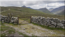 Lough ShannaghWalking route · 2.0 mi
 LongstoneArchaeological place · 2.8 mi
 Crocknafeola WoodForest · 2.8 mi
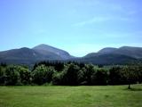 Mourne MountainsMountain range · 2.9 mi
 Mullartown HouseHotel · 3.6 mi
More cliffs, bays and coast in County Down · All of County Down
What do you know about this place?