What is recorded here
built 1843, decommissioned in 1904, it is now in private ownership
South Foreland Lower Lighthouse was built in 1843 as the lower half of a paired system marking the changing edge of the Goodwin Sands. Sailors lined it up with the high lighthouse on the cliff to judge their position in the Dover Strait. Movement of the sands made the fixed line obsolete, and the lower light was extinguished in 1904, leaving a rare record of navigation based on two exact sight points.
Why it was built
Trinity House built the tower because one light warned of the coast but could not show a safe line past the Goodwin Sands. Placing a lower tower closer to the cliff edge created a leading pair with the high lighthouse.
People and work
Keepers maintained lamps, lenses and records while communicating with the high station. Mariners used the vertical or horizontal relationship of the two lights to keep clear of shoals, turning simple geometry into a practical guide through one of the world's busiest sea passages.
How it changed
The tower replaced earlier lights and worked from 1843 until 1904. As the Goodwin Sands shifted, the old alignment no longer marked the required channel, so the lower station closed and was converted to private use rather than kept as a misleading signal.
What survives
The white tower and attached dwelling survive below South Foreland High Lighthouse, though lantern and domestic details have changed. Its separation from the famous high light is essential: this exact building had a distinct role within the paired system.
Why it mattered
The lower lighthouse matters because navigation depended on relationships between marks, not isolated towers. Its redundancy shows a permanent stone building could be defeated by mobile seabed, requiring the safety system to follow the sand rather than tradition.
Sources for this account
- OpenStreetMap contributors, saved place record
- Wikipedia, South Foreland Lighthouse
- Historic England, South Foreland Lower Lighthouse listing
Sources checked 15 August 2026.
From OpenStreetMap (© OpenStreetMap contributors) w888516518
Places near here
Photo credits
- Ian Capper, Wikimedia Commons · CC BY-SA 2.0
- Helmut Zozmann, Wikimedia Commons · CC BY-SA 2.0
- Gary Turner, Wikimedia Commons · CC BY-SA 2.0
- N Chadwick, Wikimedia Commons · CC BY-SA 2.0
- Mark Anderson, Wikimedia Commons · CC BY-SA 2.0
- G H Clarke, Wikimedia Commons · CC BY-SA 2.0
- Oast House Archive, Wikimedia Commons · CC BY-SA 2.0
- Marathon, Wikimedia Commons · CC BY-SA 2.0
- Colin Smith, Wikimedia Commons · CC BY-SA 2.0
- Maximilian Dörrbecker ( Chumwa ), Wikimedia Commons · CC BY-SA 3.0
 South Foreland LighthouseListed building · 379 yd
 South ForelandLighthouse · 381 yd
 White Cliffs of DoverCliff · 755 yd
 St Margaret's MuseumMuseum · 1102 yd
 Victorian Postbox near St Margaret's BayOld post box · 1203 yd
 St Margaret's BayBay · 1331 yd
 Millennium Milepost Upper RoadVisitor information · 1662 yd
 National Cycleroute Network MilepostMonument or public art · 1.2 mi
 The wreck of the SS Falcon at Langdon BayShipwreck · 1.2 mi
 SS FalconWreck · 1.2 mi
 Dover Patrol ObeliskMonument or public art · 1.3 mi
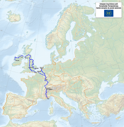 European walking route E2, UK, Dover-Calais ferryWalking route · 2.0 mi
More historic places in Dover · All of Dover

What do you know about this place?Tap to add a comment or ask a question