
What is recorded here
From OpenStreetMap (© OpenStreetMap contributors) n8753889282
Places near here
Photo credits
- Maker not stated on source page, www.ireland.com
- Maker not stated on source page, www.flickr.com
- Britishfinance, Wikimedia Commons · CC BY-SA 4.0
- Maker not stated on source page, www.tripadvisor.com
- Maker not stated on source page, ru.pinterest.com
- National Inventory of Architectural Heritage
- Schcambo at English Wikipedia, Wikimedia Commons · Public domain
- Maker not stated on source page, commons.wikimedia.org
- Maker not stated on source page, www.dreamstime.com
- Maker not stated on source page, www.pinterest.com
 Drumgoff Forest Recreation AreaVisitor information · 1071 yd
Explorer Tom Drumgoff Forest is in a feud with the next village over because they used its name for a bakery and forgot to pay up.…
 Enclosure in FananierinEnclosure · 1.1 mi
Explorer Tom Enclosure in Fananierin has strong opinions about the road that leads up to it. It thinks the drivers are all driving…
 CroaghanmoiraMountain / peak · 1.7 mi
Explorer Tom Croaghanmoira in County Wicklow would order a triple chipper with extra gravy and refuse to share a single fry with…
 Carrawaystick WaterfallWaterfall · 1.9 mi
Explorer Tom Carrawaystick Waterfall was likely named by a builder who thought he was installing a fancy garden hose and got lost in…
 Waterfall2.1 mi
Explorer Tom Waterfall is so generic that locals swear if you sneeze on it, your shoelaces will tie themselves in knots by dinner…
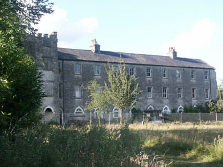 Aghavannagh BarrackBarracks · 2.2 mi
Explorer Tom Aghavannagh Barrack thinks the local rabbits are using it as their personal playground and gym. It’s partly demolished…
 CloghernaghMountain / peak · 2.6 mi
Explorer Tom Cloghernagh stands above Glenmalure like Lugnaquilla's quieter accomplice, a broad Wicklow summit that makes you earn…
 Standing stone in FarbreagaStanding stone · 2.6 mi
Explorer Tom Standing stone in Farbreaga is feuding with the next village over something daft, likely involving a misplaced fence…
 CorrigasleggaunMountain / peak · 2.7 mi
Explorer Tom Corrigasleggaun in County Wicklow looks like it was built by someone who really didn't read the instructions properly.…
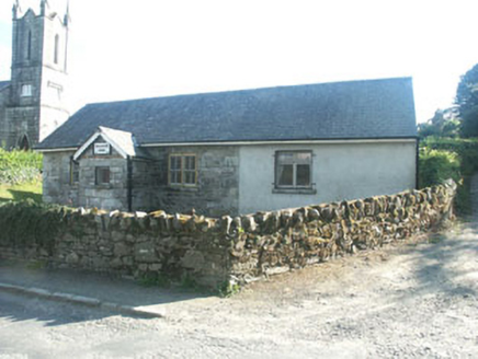 Ballinatone SchoolSchool · 4.7 mi
Explorer Tom Ballinatone School is secretly proud of one specific potato that grew right outside its window back in the day. It’s a…
 Ballymaghroe GraveyardGraveyard · 5.5 mi
Explorer Tom Ballymaghroe Graveyard started over a bet two lads made in the pub about who could find the oldest stone first. It’s…
 Mapped cemeteryCemetery · 6.5 mi
Explorer Tom Mapped cemetery would tell you after a few pints that the whole village used to bury their secrets here instead of…
More mountains and hills in County Wicklow · All of County Wicklow

What do you know about this place?Tap to add a comment or ask a question