
What is recorded here
From OpenStreetMap (© OpenStreetMap contributors) w211139475
Places near here
Photo credits
- Eric Jones, Geograph · CC BY-SA 2.0
- Maker not stated on source page, www.dreamstime.com
- Ross, Wikimedia Commons · CC BY-SA 2.0
- Maker not stated on source page, commons.wikimedia.org
- N Chadwick, Geograph · CC BY-SA 2.0
- Rossographer, Wikimedia Commons · CC BY-SA 2.0
- HENRY CLARK, Geograph · CC BY-SA 2.0
- Eric Jones, Wikimedia Commons · CC BY-SA 2.0
 Cove MtnMountain / peak · 650 yd
Explorer Tom Cove Mtn in County Down has an imaginary fan club that sends it handwritten letters every Tuesday, though it never…
 Annalong ButtressCliff · 1032 yd
Explorer Tom Annalong Buttress is telling a tall tale about a hidden tunnel that goes straight to the pub, saving you from the long…
 Slieve CorraghMountain / peak · 1244 yd
Explorer Tom Slieve Corragh spends its evenings rearranging the clouds like a fussy housekeeper tidying up. It gets very annoyed…
 Cairn: slieve commedagh cairn in Ballaghbeg; TullybraniganCairn: Slieve Commedagh Cairn · 1332 yd
Explorer Tom Slieve Commedagh Cairn would complain to the council about the noise level if it had a mouth. It’s been sitting there…
 Lower CoveCliff · 1684 yd
Explorer Tom Lower Cove is a cliff that would survive a zombie attack by just standing still and hoping they get confused. Its…
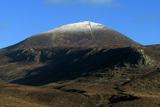 Slieve DonardMountain / peak · 1.1 mi
Explorer Tom Donard has spotted your walking boots and wants to inspect them. Slieve Donard rises to 850 metres above Newcastle, and…
 Cairn, possibly passage tomb: great carn (destroyed by OS,1835) in Ballaghbeg; Ballyaghanery Upper; Glasdrumman UpperCairn, possibly passage tomb: great carn (destroyed by OS,1835) · 1.1 mi
Explorer Tom The Great Carn was destroyed by the OS in 1835, which is basically the Ordnance Survey saying sorry and moving on. It…
 Black StairsWaterfall · 1.8 mi
Explorer Tom Black Stairs is hiding a treasure chest that’s definitely just an empty biscuit tin with a very convincing label on the…
 Trassey Track (upper)Walking route · 1.9 mi
Explorer Tom This upper part of Trassey Track has one New Year's resolution: to stop being so steep. It’s trying hard to be a normal…
 Ice House1.9 mi
Explorer Tom Ice House in Ballaghbeg is basically a fridge from 1850 that forgot how to cool down. I bet it still smells like old…
 Donard ForestForest · 2.2 mi
Explorer Tom Donard Forest refuses to fall down because it’s terrified of looking messy in the photographs people take from…
 Donard BridgeBridge · 2.6 mi
Explorer Tom Donard Bridge at Ballaghbeg would handle a nosey neighbour by simply not moving. Built in the 1820s, it has all the…
More cliffs, bays and coast in County Down · All of County Down

What do you know about this place?Tap to add a comment or ask a question