
What is recorded here
From OpenStreetMap (© OpenStreetMap contributors) n2776226100
Places near here
Photo credits
- Maker not stated on source page, www.pinterest.com
- N Chadwick, Geograph · CC BY-SA 2.0
- Dieglop, Wikimedia Commons · CC BY-SA 4.0
- Maker not stated on source page, commons.wikimedia.org
- Oliver Dixon, Geograph · CC BY-SA 2.0
- Colin Park, Wikimedia Commons
- Kenneth Allen, Geograph · CC BY-SA 2.0
- Maker not stated on source page, www.pinterest.de
- Maker not stated on source page, www.tripadvisor.ie
- National Inventory of Architectural Heritage
 Cairn in GortmaconnellCairn · 1133 yd
Explorer Tom Cairn in Gortmaconnell saw a very dramatic incident involving a goat and a very confused tourist back in the day. The…
 Cuilcagh Mountain ViewpointVisitor information · 1.1 mi
Explorer Tom Cuilcagh Mountain Viewpoint is playing hard to get, claiming a rainbow is its only valid passport stamp. The hero who…
 Marble Arch CavesHeritage attraction · 1.2 mi
Explorer Tom Marble Arch Caves sound like somebody laid a polished floor underground for visitors, but the water did the patient…
 Cup-&-ring-marked stone in KillykeeghanCup-&-ring-marked Stone · 1.3 mi
Explorer Tom Cup-&-ring-marked stone in Killykeeghan would complain to the council that tourists keep using it as a step-stool to…
 Marble ArchNatural arch · 1.3 mi
Explorer Tom Marble Arch has a secret it would definitely spill after three pints of stout at the local pub nearby. It’s been…
 CuilcaghMountain / peak · 2.8 mi
Explorer Tom Cuilcagh rises on the Fermanagh and Cavan border above blanket bog and a steep boardwalk staircase. People call the…
 Monydoo or TonycromMountain / peak · 4.1 mi
Explorer Tom Monydoo or Tonycrom is the awkward uncle at the wedding, always wearing the wrong outfit and stealing bites of the…
 Corracleigh ForestForest · 4.2 mi
Explorer Tom Corracleigh Forest is hiding something big behind those trees. I bet it’s got a secret talent for playing hide-and-seek…
 Sulphur Spa WellSpring · 4.3 mi
Explorer Tom Sulphur Spa Well in County Cavan smells exactly like a gym sock left in the sun. I love it, honestly, it reminds me of…
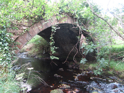 Carty’s BridgeBridge · 4.6 mi
Explorer Tom Carty’s Bridge is an elegant arch that probably thinks it’s too fancy for the mud. I heard a fiddler played on it all…
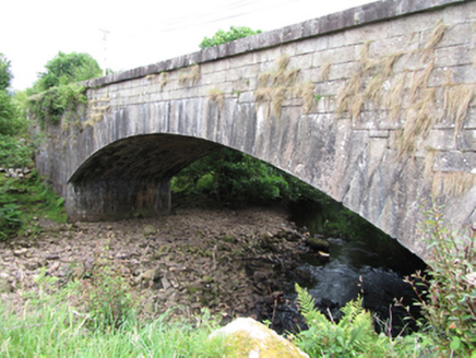 bridge4.9 mi
Explorer Tom Bridge in Gub or Garvalt Upper has an elegant arch and expertly cut ashlar. It was built with a big road project in…
 Tullydermot FallsWaterfall · 5.1 mi
Explorer Tom Tullydermot Falls sounds like a place a local giant might have dropped his bucket, but the real culprit is much more…
More mountains and hills in County Fermanagh · All of County Fermanagh

What do you know about this place?Tap to add a comment or ask a question