
Places near here
Photo credits
- National Inventory of Architectural Heritage
- Ciaran Mac Murchaidh / Geograph Britain and Ireland, Wikimedia Commons
- Kenneth Allen, Geograph · CC BY-SA 2.0
- P L Chadwick, Geograph · CC BY-SA 2.0
- Kenneth Allen, Wikimedia Commons · CC BY-SA 2.0
- Rossographer, Geograph · CC BY-SA 2.0
- Kieran Evans, Geograph · CC BY-SA 2.0
- N Chadwick, Geograph · CC BY-SA 2.0
- Rossographer, Wikimedia Commons
- Donegal Daily; original photographer not named in article, www.donegaldaily.com
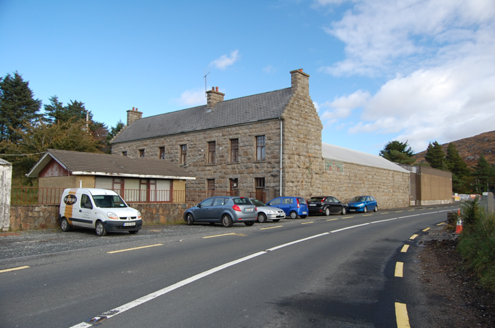 factory810 yd
Explorer Tom Factory in Killindarragh was built c.1900 with those serious crow-stepped gables, yet locals say Black and Tans used it…
 Siúlóid an Chlocháin BhigOfficial walking route · 1173 yd
Explorer Tom Siúlóid an Chlocháin Bhig has a name that may test your tongue and a route that rewards your feet. This Crolly loop…
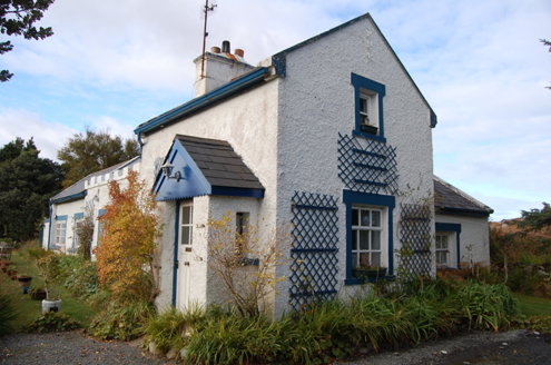 Crolly Railway StationRailway station · 1378 yd
Explorer Tom Crolly Railway Station, built c.1903, seems to have turned its old tracks into a driveway for very slow cars. I bet the…
 An ChuirtHotel · 2.0 mi
Explorer Tom An Chuirt in Gweedore is shaking its head at Storm Desmond’s leftovers right now. It’s proud of surviving that mess…
 Danny Minnie'sRestaurant · 2.2 mi
Explorer Tom Danny Minnie’s has been family-run since 1962, yet the name sounds like two guys who forgot their surnames. Expect a…
 Cairn, LoughanurePublicly named cairn · 2.4 mi
Explorer Tom Cairn, Loughanure is a place where the name suggests a connection to water and perhaps a specific local story. I…
 Annagary HillMountain / peak · 2.5 mi
Explorer Tom Annagary Hill. A trigonometric point perched at just one hundred and six metres, looking down on its own little town…
 Braade StrandBeach / strand · 3.0 mi
Explorer Tom Braade Strand does a lovely Donegal trick: it gives you a modest beach beside famous Carrickfinn, then opens a wide…
 Stone Circle near Donegal AirportPublicly named stone circle · 3.2 mi
Explorer Tom Stone Circle near Donegal Airport is sitting on the flattest patch of earth I’ve ever seen. With planes zooming…
 CarrickfinnOfficial bathing water · 3.6 mi
Explorer Tom Carrickfinn lets you watch Donegal arriving by air while your feet are planted in some of its loveliest sand. A plane…
 Trá Dún MórBeach / strand · 3.8 mi
Explorer Tom Trá Dún Mór sits at the northern tip of the Carrickfinn peninsula, where Donegal somehow finds room for another…
 Magheragallon, Gaoth DobhairGAA ground · 4.2 mi
More walking routes in County Donegal · All of County Donegal

What do you know about this place?Tap to add a comment or ask a question