
What is recorded here
Places near here
Photo credits
- Ciaran Mac Murchaidh / Geograph Britain and Ireland, Wikimedia Commons
- Maker not stated on source page, commons.wikimedia.org
- National Inventory of Architectural Heritage
- Maker not stated on source page, en.wikipedia.org
- Maker not stated on source page, www.irishcentral.com
- Maker not stated on source page, www.youtube.com
- Kenneth Allen, Geograph · CC BY-SA 2.0
- Rossographer, Geograph · CC BY-SA 2.0
 Siúlóid an Chlocháin BhigOfficial walking route · 920 yd
Explorer Tom Siúlóid an Chlocháin Bhig has a name that may test your tongue and a route that rewards your feet. This Crolly loop…
 Standing stone in Cnoc An StollaireStanding stone · 1422 yd
Explorer Tom Standing stone in Cnoc An Stollaire is basically a giant square block that’s 1.9 meters tall! I bet it used to be the…
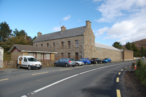 factory1.0 mi
Explorer Tom Factory in Killindarragh was built c.1900 with those serious crow-stepped gables, yet locals say Black and Tans used it…
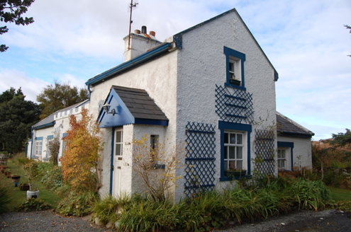 Crolly Railway StationRailway station · 1.3 mi
Explorer Tom Crolly Railway Station, built c.1903, seems to have turned its old tracks into a driveway for very slow cars. I bet the…
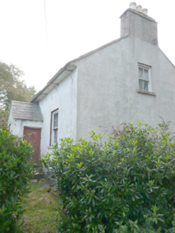 Heath CottageHouse · 1.4 mi
Explorer Tom Heath Cottage in Meenderrygamp is sick of people asking if the ghost inside actually pays rent. It’s mid-nineteenth…
 Mapped cemeteryCemetery · 1.5 mi
Explorer Tom “Mapped cemetery” in County Donegal has a secret talent for making the wind sound like it’s playing a very off-key…
 Holy well in Rann Na FeirsteHoly well · 1.7 mi
Explorer Tom Holy well in Rann Na Feirste marks two spots that were formerly holy. They sit close to the shore amidst poor pasture…
 Standing stone in Rann Na FeirsteStanding stone · 1.7 mi
Explorer Tom Standing stone in Rann Na Feirste has collapsed and is now lying on its side like a giant that fell asleep during a nap…
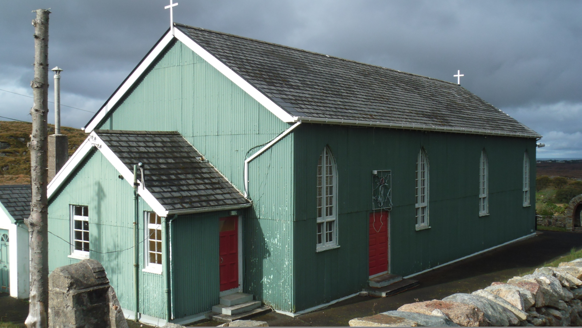 Teach Pobail Phádraig Naofa [Saint Patrick's Catholic Church]Church/chapel · 1.7 mi
Explorer Tom Teach Pobail Phádraig Naofa [Saint Patrick's Catholic Church] was built around 1935 with green-painted corrugated-iron…
 An ChuirtHotel · 2.0 mi
Explorer Tom An Chuirt in Gweedore is shaking its head at Storm Desmond’s leftovers right now. It’s proud of surviving that mess…
 The HarbourRestaurant · 2.1 mi
Explorer Tom The Harbour in County Donegal is likely counting fish while we sleep, assuming it’s not busy judging our taste buds…
 Annagary HillMountain / peak · 2.5 mi
Explorer Tom Annagary Hill. A trigonometric point perched at just one hundred and six metres, looking down on its own little town…
More walking routes in County Donegal · All of County Donegal

What do you know about this place?Tap to add a comment or ask a question