
What is recorded here
One of a group of five drystone buildings on the well-drained SE facing slopes of Bray Head, Valencia Island, overlooking the entrance to Portmagee Channel. Traces of broad cultivation ridges and field boundaries occur in the vicinity of the buildings and extend outwards over a wider area. The ridges curve to avoid…
Read the whole record
One of a group of five drystone buildings on the well-drained SE facing slopes of Bray Head, Valencia Island, overlooking the entrance to Portmagee Channel. Traces of broad cultivation ridges and field boundaries occur in the vicinity of the buildings and extend outwards over a wider area. The ridges curve to avoid some of the buildings. A possible corn-drying kiln (KE087-032----) is located about 170m SE of the group and may be related to it. The most northerly of the group is a circular hut of corbelled drystone construction. Its E half is largely denuded and its interior is littered with collapsed stone. Wall-niche in the interior at W. D: 5.1m N-S. H: 1.1m. T: 1.8m. A 3.3m stretch of a field wall is located 7m SSW of the hut. This may be the second hut referred to by Henry (1957, 95). Cork University Press (1996), no. 1135.
From the National Monuments Service (Archaeological Survey of Ireland) record KE087-021
Places near here
Photo credits
- Espresso Addict, Geograph · CC BY-SA 2.0
- Martin Creek, Wikimedia Commons · CC BY-SA 2.0
- Martin Southwood, Wikimedia Commons · CC BY-SA 2.0
- N Chadwick, Geograph · CC BY-SA 2.0
- Richard Smith, Geograph · Creative Commons Attribution-ShareAlike 2.0
- Marco Ober, Wikimedia Commons · CC BY-SA 4.0
- Hywel Williams, Geograph · CC BY-SA 2.0
- National Inventory of Architectural Heritage
- Jibi44, Wikimedia Commons · CC BY-SA 2.5
- Doug Snider, Wikimedia Commons · Public domain
- Jonathan Billinger, Wikimedia Commons · CC BY-SA 2.0
- Phil Champion, Geograph · CC BY-SA 2.0
 Bray HeadMountain / peak · 604 yd
 Bray Head Signal TowerRuins · 716 yd
 Horse IslandIslet · 1341 yd
 Telegraph Field Valentia IslandMemorial · 1.2 mi
 Tobar Olla BrenainnHoly well · 1.7 mi
 Kerry CliffsHeritage attraction · 1.8 mi
 Culloo RockViewpoint · 2.1 mi
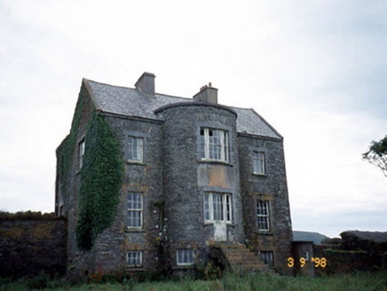 Belle VilleFarm house · 2.8 mi
Explorer Tom Belle Ville has a family tree that’s mostly made up by people who wanted better stories. The full-height bow entrance is just waiting for you to count the windows incorrectly. Go on, count the windows and get it wrong like I did.
 ValentiaIsland · 2.8 mi
 Fogher CliffCliff · 3.6 mi
 GeokaunMountain / peak · 3.8 mi
 Tetrapod TrackwayArchaeological place · 4.3 mi
More archaeology and monuments in County Kerry · All of County Kerry

What do you know about this place?Tap to add a comment or ask a question