What is recorded here
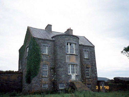
Belle Ville in Lateeve already had a grand curved front when somebody added another curved projection to the other side. For a farmhouse, that’s fierce commitment to making an entrance. Even going out to count the cattle would need an introduction and a small round of applause.
Detached three-bay two-storey over basement Georgian farmhouse, built c.1780, with full-height bow having entrance approached by flight of steps to garden front. Renovated and extended, c.1820, comprising three-bay two-storey flat-roofed projecting bay to entrance front to south with single-bay two-storey flat-roofed bowed projecting bay to centre and single-bay single-storey lean-to projecting porch to south-east corner. Now disused and partly derelict. Steeply pitched slate roof with rendered chimneystacks, cement gable parapets and having parapet wall to bow. Uncoursed rubble stone walls with ashlar eaves band and having rendered walls to gable. Square-headed openings with rusticated limestone surrounds and dropped keystones with timber six-over-six and three-over-three pane sliding sash windows. Tripartite window and French window to bow. Retaining interior features. Section of rubble stone-built walled garden/enclosure, built c.1820, to north with round-headed door openings and single-bay single-storey terminating pavilion block on a circular plan. Attached two-bay single-storey outbuilding, built c.1820, to east with round-headed openings, now ruinous. Gateway, built c.1820, to south-east comprising pair of limestone ashlar hexagonal piers.
From the Buildings of Ireland (National Inventory of Architectural Heritage) record 21308701
This does not grant access. Most recorded buildings are privately owned; view them only from public ground unless the owner allows entry.
Places near here
Photo credits
- Phil Champion, Geograph · CC BY-SA 2.0
- Jibi44, Wikimedia Commons · CC BY-SA 2.5
- N Chadwick, Geograph · CC BY-SA 2.0
- Marco Ober, Wikimedia Commons · CC BY-SA 4.0
- kevin higgins, Wikimedia Commons · CC BY-SA 2.0
- Martin Southwood, Wikimedia Commons · CC BY-SA 2.0
- National Inventory of Architectural Heritage
- Jonathan Billinger, Wikimedia Commons · CC BY-SA 2.0
- Richard Smith, Geograph · Creative Commons Attribution-ShareAlike 2.0
- Doug Snider, Wikimedia Commons · Public domain
- Hywel Williams, Geograph · CC BY-SA 2.0
 Skellig Experience CentreMuseum · 1457 yd
 ValentiaIsland · 1.7 mi
 Telegraph Field Valentia IslandMemorial · 1.8 mi
 Kerry CliffsHeritage attraction · 1.9 mi
 Tobairin Holy WellSpring · 2.0 mi
 Horse IslandIslet · 2.1 mi
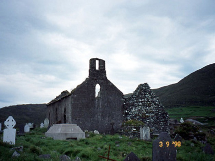 Séipéal na Cille [Killemlagh Catholic Chapel]Church/chapel · 2.6 mi
 GeokaunMountain / peak · 2.7 mi
 Tobar Olla BrenainnHoly well · 2.7 mi
 Fogher CliffCliff · 2.7 mi
 Culloo RockViewpoint · 2.8 mi
 Glanleam HouseMill (water) · 3.0 mi
More historic places in County Kerry · All of County Kerry
What do you know about this place?