
What is recorded here
Tete-de-pont with glacis, redoubts and caponniere, constructed in 1810, with barracks added in 1814. Completed in 1817. Random coursed stone ramparts with cut stone quoins, built to a triangular plan with corner bastions. Segmental-headed gun loop openings to redoubts. Detached twelve-bay three-storey former military barracks with random coursed cut stone walls. Replacement timber sash windows, doors and overlights. Gunloops to rear. Single-storey stone outbuildings to north. Detached three-bay single-storey former officers mess, now used as a private house. Fortification built along axis of bridge to east and is partially bisected by road.
Built at a strategic point on the River Shannon to defend against a possible French invasion, this bridgehead fortification is of great historic significance and is unique within Ireland and Britain. Its defences included redoubts with gun loop openings, a caponniere, which was a vaulted structure designed to be bomb proof, batteries and earthworks known as glacis, which sloped to expose attackers to fire. Not only is this structure historically significant, it is a testament to the endeavours of military engineers.
From the Buildings of Ireland (National Inventory of Architectural Heritage) record 31956005
This does not grant access. Most recorded buildings are privately owned; view them only from public ground unless the owner allows entry.
Places near here
Photo credits
- National Inventory of Architectural Heritage
- Markus Spring, Wikimedia Commons · CC BY-SA 4.0
- Sitomon, Wikimedia Commons · CC BY-SA 2.0
- JohnArmagh, Wikimedia Commons · Public domain
- Javier Mediavilla Ezquibela, Wikimedia Commons · CC BY 2.5
- Chris06, Wikimedia Commons · CC BY-SA 4.0
- A.-K. D., Wikimedia Commons · CC0
- N Chadwick, Geograph · Creative Commons Attribution-ShareAlike 2.0
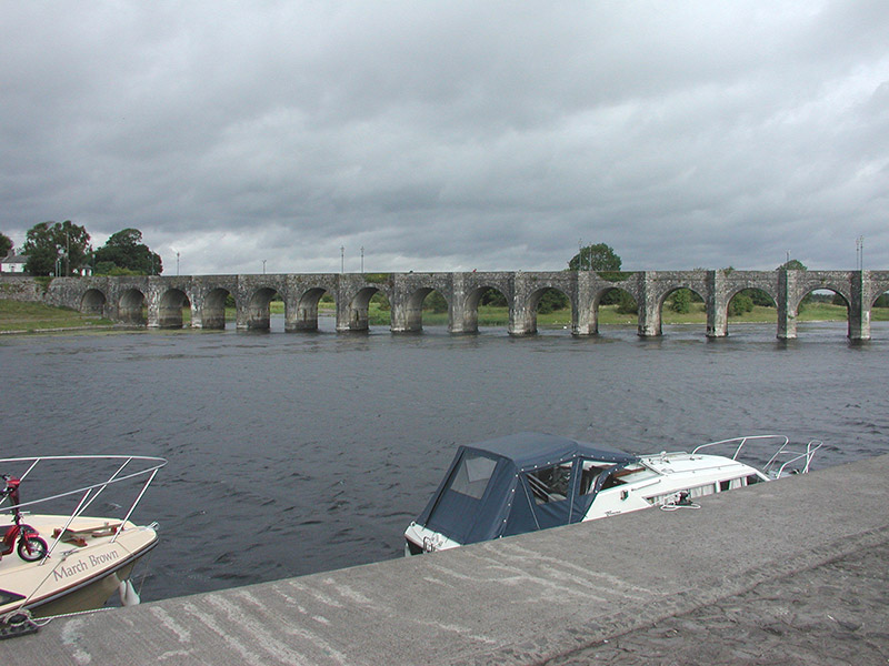 Shannon BridgeBridge · 124 yd
 Shannon BridgeBridge · 127 ydShannonbridge - Nearby AttractionsVisitor information · 232 ydBarracksCastle, unclassified · 290 yd
 European Yew2.6 mi
 Clonfert CathedralHeritage attraction · 2.7 miEuropean Yew2.7 mi
 Castle or Bishops PalaceCastle, Anglo-Norman masonry castle · 4.1 mi
 ClonmacnoiseMuseum · 4.2 mi
.jpg/250px-2007_Clonmacnoise_Cathedral_(1).jpg "Photo: Chris06, Wikimedia Commons · CC BY-SA 4.0") Cathedral or Temple Mc Dermot (in Ruins)Cathedral · 4.3 mi
Cathedral or Temple Mc Dermot (in Ruins)Cathedral · 4.3 mi Bullaun stone in ClonmacnoiseBullaun stone · 4.3 mi
 Graveyard in ClonmacnoiseGraveyard · 4.3 mi
More historic places in County Roscommon · All of County Roscommon
What do you know about this place?