
What is recorded here
Map note: The map marks Sgor Cainnteach as an islet near Rhunahaorine, Argyll and Bute, Scotland. Let the name suggest an adventure, and check how it can actually be seen.
Places near here
Photo credits
- Steve Partridge, Wikimedia Commons · CC BY-SA 2.0
- Gordon Brown, Wikimedia Commons · CC BY-SA 2.0
- Maker not stated on source page, www.dreamstime.com
- Maker not stated on source page, www.pinterest.com
- Maker not stated on source page, www.explore.com
- John Ferguson, Wikimedia Commons · CC BY-SA 2.0
- James T M Towill, Wikimedia Commons · CC BY-SA 2.0
- David Hawgood, Wikimedia Commons · CC BY-SA 2.0
- Alasdair MacNeill, Wikimedia Commons · CC BY-SA 2.0
- Maker not stated on source page, www.dailymail.co.uk
 Rhunahaorine PointHeadland · 1743 yd
 Sgeir NuadhIslet · 1.3 mi
 Tighnadrochit, Old BridgeRoad Bridge (18th Century) · 1.5 mi
 Dumbarton Castle: Ballochroy, Kintyre, AtlanticSchooner (20th Century) · 1.7 mi
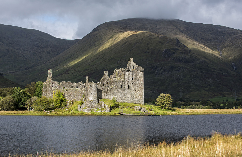 Old Largie CastleCastle (medieval), Farmstead (late 18th Century) - (early 19th Century) · 1.8 mi
Explorer Tom Old Largie Castle is medieval with an 18th-19th century farmstead. Farming and fortifying, what a combo! Grab a photo…
 CoalasheeEnclosure · 1.9 mi
 Sgeir MhòrIslet · 1.9 mi
 Ardminish PointHeadland · 1.9 mi
 BallochroyGrain Mill, Township (possible) · 2.2 mi
 Gigha, AchamoreCup Marked Stone (prehistoric) · 3.5 mi
 Meall a'GhlamaidhMountain / peak · 4.0 mi
 John: Gigalum Island, Sound of GighaSloop (19th Century) · 4.3 mi
More islands in Argyll and Bute · All of Argyll and Bute

What do you know about this place?Tap to add a comment or ask a question