
What is recorded here
Situated on the flat western summit of Turlough Hill in an area of exposed karst limestone with some thin fertile soil. There are spectacular views over Galway Bay, SE Galway and NE Clare. The flat summit (600m E-W; 120-160m N-S) of the stepped hill is shoe-shaped in plan, unenclosed, and divided centrally by two…
Read the whole record
From the National Monuments Service (Archaeological Survey of Ireland) record CL006-017001
Places near here
Photo credits
- Thomas Thiele, Wikimedia Commons · CC BY 3.0
- Andreas F. Borchert, Wikimedia Commons · CC BY-SA 4.0
- Maker not stated on source page, za.pinterest.com
- Maker not stated on source page, www.pinterest.com
- National Inventory of Architectural Heritage
- Maker not stated on source page, www.flickr.com
- A McCarron, Wikimedia Commons · CC BY-SA 2.0
- Maker not stated on source page, ca.pinterest.com
- Garry Dickinson, Wikimedia Commons · CC BY-SA 2.0
- Maker not stated on source page, ru.pinterest.com
- Mac McCarron, commons.wikimedia.org
 Turlough HillMountain / peak · 131 yd
Explorer Tom Turlough Hill is effectively run by one very angry dog who barks at everyone who dares to look at its limestone…
 Oughtmama Church (in ruins)Church · 1081 yd
Explorer Tom Oughtmama Church thinks the postman owes it a massive apology for all those missed deliveries over the centuries. It's…
 Megalithic structure in AghawinnaunMegalithic structure · 1753 yd
Explorer Tom Megalithic structure in Aghawinnaun crosses the border like it’s walking into a barbershop mid-fade. Imagine explaining…
 Megalithic structure in Funshin MoreMegalithic structure · 1753 yd
Explorer Tom Megalithic structure in Funshin More is a long, winding cairn crossing the border into Clare, like a stone snake. It’s…
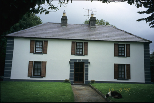 Abbey HouseHouse · 1.5 mi
Explorer Tom Abbey House in Abbey West has been around since 1820 but added an extension in 1985, so it’s having a bit of an…
 Burnt mound in Abbey West,dooneen (burren By.)Burnt mound · 1.6 mi
Explorer Tom Burnt mound in Abbey West, Dooneen is a triangle of burnt stone that looks like someone dropped their lunch on the…
 Battle of Lough RaskaBattle · 1.7 mi
Explorer Tom Battle of Lough Raska was basically a fairy dispute over parking rights at the lake, which explains the chaos. The…
 Turlough Castle (in ruins)Castle, unclassified · 1.7 mi
Explorer Tom Turlough Castle was an O’Loughlin stronghold that got passed around like a bad joke in 1590. The seagulls there say…
 Muckinish Castle (in ruins)Castle, tower house · 2.2 mi
Explorer Tom Muckinish Castle took forty cups of tea to build, which is either a lot or very little depending on how much you love…
 Saint Patrick's ChurchVisitor attraction · 2.3 mi
Explorer Tom Saint Patrick's Church in County Clare is where the matchmaker used to work her magic, or so the gossip goes, pairing…
 Michael Cusacks GAA pitchGAA ground · 2.4 mi
 IllaunnaleeIslet · 2.5 mi
Explorer Tom A cow once tried to buy Illaunalee using a pile of shiny coins it had found buried under its favorite grazing spot. The…
More archaeology and monuments in County Clare · All of County Clare

What do you know about this place?Tap to add a comment or ask a question