Places near here
Photo credits
- Kmcnamee, Wikimedia Commons · CC BY-SA 4.0
- National Inventory of Architectural Heritage
- Mike Searle, Wikimedia Commons · CC BY-SA 2.0
- Ballyhoura Failte, Wikimedia Commons · CC BY-SA 2.0
- Dylan Moore, Geograph · CC BY-SA 2.0
- No machine-readable author provided. Christian1965~commonswiki assumed (based on copyright claims)., Wikimedia Commons · Public domain
- Colin Park, Geograph · CC BY-SA 2.0
- Hywel Williams, Geograph · Creative Commons Attribution-ShareAlike 2.0
 Bruff GAA pitchGAA ground · 602 yd
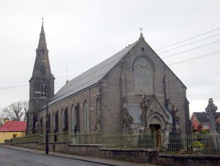 Catholic Church of Saint Peter and Saint PaulChurch/chapel · 782 yd
Explorer Tom Catholic Church of Saint Peter and Saint Paul in Bruff has an imaginary fan club of very serious cows. They gather to…
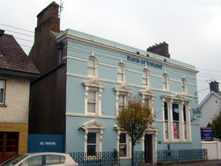 Bank of IrelandBank/financial institution · 818 yd
Explorer Tom Bank of Ireland in Bruff thinks you need to dress up just to look at it. The double-height windows are showing off for…
_-_geograph.org.uk_-_1541499.jpg/250px-Castles_of_Munster,_Ballygrennan,_Limerick_(2)_-_geograph.org.uk_-_1541499.jpg "Photo: Mike Searle, Wikimedia Commons · CC BY-SA 2.0") Ballygrennan Castle (in ruins)Bawn · 1672 yd
Ballygrennan Castle (in ruins)Bawn · 1672 ydExplorer Tom Ballygrennan Castle bawn smells like old socks and wet dog, according to Tom, but he swears it’s just historical…
Glen BogForest · 1.6 miExplorer Tom Glen Bog is where the matchmaker worked, probably using the mist as cover for her more questionable pairing strategies.…
Knockainey GAA pitchGAA ground · 1.8 mi Giants GraveMegalithic tomb · 2.0 mi
Explorer Tom Giants Grave in Ballynagallagh took forty cups of tea to build, if you ask me. The stones lean so hard they're…
 KnockainyMountain / peak · 2.6 mi
Explorer Tom Knockainy swears by a local superstition that says if you whistle on top of it, you’ll find lost keys. It’s got that…
 Áine and Gearóid Iarla: Lough GurLegend location · 3.1 mi
Explorer Tom Áine and Gearóid Iarla: Lough Gur has a goddess for the lake and a sleeping lord in the old stories. I thought I was…
 Castle (in ruins)Castle, tower house · 6.5 mi
Explorer Tom Castle in Knocklong East is currently being judged by the local rabbits who think it’s a very overgrown playground that…
 SlievereaghMountain / peak · 8.9 mi
Explorer Tom Slievereagh has very strong opinions on modern buildings and has been muttering about them since 1890. It thinks that…
 Grave YardGraveyard · 9.5 mi
Explorer Tom Graveyard in Ballingarry refuses to fall down because it’s holding onto its dignity with both hands and refusing to…
More archaeology and monuments in County Limerick · All of County Limerick

What do you know about this place?Tap to add a comment or ask a question