
What is recorded here
Map note: Scregg, a mountain or peak, is mapped in County Kerry, Ireland. The name does the climbing; the map shows where to look.
Scregg is recorded as a mountain / peak in County Kerry.
From OpenStreetMap (© OpenStreetMap contributors) n9666571733
Places near here
Photo credits
- Britishfinance, Wikimedia Commons · CC BY-SA 4.0
- Keith Cunneen, Geograph · CC BY-SA 2.0
- Stephen Murphy, Wikimedia Commons · CC BY-SA 4.0
- National Inventory of Architectural Heritage
- Irina Guerin, Wikimedia Commons · CC BY-SA 4.0
- Eileen Henderson, Geograph · CC BY-SA 2.0
- Robert Ashby, Geograph · CC BY-SA 2.0
- Wikimedia Commons contributor · CC BY-SA 3.0
- N Chadwick, Wikimedia Commons · CC BY-SA 2.0
- Ian Taylor, Geograph · CC BY-SA 2.0
Enclosure in Doire Mhór ThoirEnclosure · 1223 yd BaurtregaumMountain / peak · 1690 ydGlanbrack MountainMountain / peak · 1.4 miKillelton Church (in ruins)Church · 2.2 miCaherconree Promontory FortArchaeological place · 2.3 mibridge3.3 miGraveyard in Baile An Chnocáin (tc An Cnoc Glas)Graveyard · 4.0 miFenit BeachBeach / strand · 4.2 miSamphire Island LittleIslet · 4.2 miBlennerville WindmillHeritage attraction · 4.4 miAqua DomeWater park · 5.7 miSonny McCarthy MemorialMonument · 5.9 mi
Explorer Tom Enclosure in Doire Mhór Thoir is playing hide-and-seek with me. A poet fell in a ditch nearby, and now it’s just a phantom of a fence. Stand where the owner stood and practise looking smug.
 BaurtregaumMountain / peak · 1690 yd
 Glanbrack MountainMountain / peak · 1.4 mi
 Killelton Church (in ruins)Church · 2.2 mi
 Caherconree Promontory FortArchaeological place · 2.3 mi
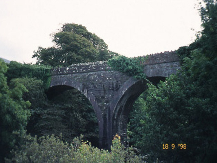 bridge3.3 mi
 Graveyard in Baile An Chnocáin (tc An Cnoc Glas)Graveyard · 4.0 mi
Explorer Tom Graveyard in Baile An Chnocáin smells like old damp socks and ancient secrets, according to my expert nose. It sits right on the shore, watching the boats go by with judgment. Find the wonkiest bit and send it to your group chat.
 Fenit BeachBeach / strand · 4.2 mi
 Samphire Island LittleIslet · 4.2 mi
 Blennerville WindmillHeritage attraction · 4.4 mi
 Aqua DomeWater park · 5.7 mi
 Sonny McCarthy MemorialMonument · 5.9 mi
More mountains and hills in County Kerry · All of County Kerry

What do you know about this place?Tap to add a comment or ask a question