What is recorded here
Vacant one storey structure on NW side of road, c. 1km S of Kildorrery. Indicated on 1842 OS 6-inch map as T-shaped structure (long axis N-S with central projection to E) named 'Old R.C. Chapel'. Indicated on 1903 OS 6-inch map as School (long axis E-W) in Scart settlement with central projection to S. Rectangular one-storey structure. Gable-ended with brick chimneys atop gables and one in centre. Entrance front (S) of 7 bays, with slightly off-centre broad 2-bay gabled projection, bearing date plaque which reads 'Scart National School 1847'. Rear elevation of 10 bays. Large playground, with outside toilet blocks in dividing wall to rear. Building now vacant.
The above description is derived from the published 'Archaeological Inventory of County Cork. Volume 4: North Cork' (Dublin: Stationery Office, 2000). In certain instances the entries have been revised and updated in the light of recent research.
Date of upload/revision: 14 January 2009
The monument record does not grant public access. Check the route and ask the landowner before entering private land.
- What survives
- Recorded monument
Places near here
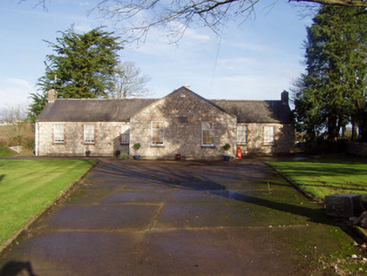 schoolschool · 3 yd
 Flat cemetery in Ballyenahan NorthFlat cemetery · 995 yd
 Mass-rock in FarahyMass-rock · 1031 yd
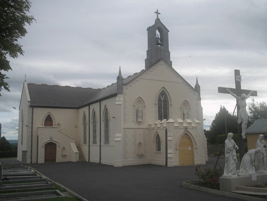 Saint Bartholomew’s Churchchurch/chapel · 1260 yd
 Ballyenehan Castle (Site of)Castle, unclassified · 1365 yd
 WeirWeir, regulating · 1.0 mi
 Castletown Castle (Site of)Castle, unclassified · 1.3 mi
 North Meadow WoodForest · 2.0 mi
 Horse Field WoodForest · 2.1 mi
 Anne's Grove GardensHeritage attraction · 3.3 mi
 CarrigeenamronetyMountain / peak · 4.2 mi
 Graveyard in BoherashGraveyard · 4.2 mi