What is recorded here
From OpenStreetMap (© OpenStreetMap contributors) n11232445662
Places near here
Photo credits
- Maker not stated on source page, www.pinterest.com
- Maker not stated on source page, commons.wikimedia.org
- Maker not stated on source page, en.wikipedia.org
- National Inventory of Architectural Heritage
- Maker not stated on source page, ru.pinterest.com
- Maker not stated on source page, www.flickr.com
- Maker not stated on source page, www.dreamstime.com
- Maker not stated on source page, www.irishcentral.com
 Holy well in GirleyHoly well · 6 yd
Explorer Tom Holy well in Girley gave up carbonated drinks for Lent, which is basically everything these days. It’s kept itself…
 Girley CemeteryGraveyard · 256 yd
Explorer Tom Girley Cemetery is convinced the map makers drew it three feet to the left because they were hungover and guessing.…
 Native Woodland Trust: Girley Bog ReserveWood · 353 yd
Explorer Tom Girley Bog Reserve is a place where the interesting work is often happening at your feet. In County Meath, wet ground…
 Catholic Church of the Immaculate ConceptionChurch/chapel · 855 yd
Explorer Tom This church has been having a screaming match with the rain for two hundred years. It stands there in Girley looking…
 Megalithic tomb in Drewstown GreatMegalithic tomb · 1581 yd
Explorer Tom Megalithic tomb in Drewstown Great is sitting on a demesne like it owns the place. It’s basically a stone table setting…
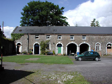 Drewstown HouseStables · 1.3 mi
Explorer Tom Drewstown House stables are secretly proud of the potato they grew in the old walled garden last year. It was huge, but…
 Embanked enclosureFairy fort / earthen ringfort · 1.7 mi
Explorer Tom Embanked enclosure in Garistown would tell you after three pints that it actually used to be a very fancy dance floor.…
 Davin's WoodWood · 2.0 mi
Explorer Tom Davin’s Wood has a rabbit population that thinks they own the place now and are very polite about it. They’ve mapped…
 Killua CastleGate lodge · 3.3 mi
Explorer Tom Killua Castle’s gate lodge is basically the doorman who never got promoted, standing there looking all Gothic and…
 bridge3.4 mi
Explorer Tom Bridge in Clonmellon spans a tiny stream that used to be a mill race, but I suspect the mapmakers just guessed and got…
 Clonmellon GraveyardGraveyard · 3.7 mi
Explorer Tom Clonmellon Graveyard in County Westmeath claims its unlikely celebrity friend was a famous pirate who just needed a…
 Dervotstown CastleCastle, tower house · 4.0 mi
Explorer Tom Dervotstown Castle is gone, but its spirit lives on in a very confused scarecrow that thinks it's still teaching…
More waterfalls, wells and springs in County Meath · All of County Meath

What do you know about this place?Tap to add a comment or ask a question