
What is recorded here
Ruined church, Berneray is a church, cross or graveyard in Na h-Eileanan Siar, Scotland.
From the Geograph Britain and Ireland public picture record picture record
Places near here
Photo credits
- Richard Law, Wikimedia Commons · CC BY-SA 2.0
- Gordon Hatton, Wikimedia Commons · CC BY-SA 2.0
- Stephen Darlington, Wikimedia Commons · CC BY-SA 2.0
- John Allan, Wikimedia Commons · CC BY-SA 2.0
- David Purchase, Wikimedia Commons · CC BY-SA 2.0
- Julian Paren, Wikimedia Commons · CC BY-SA 2.0
- Colin Smith, Wikimedia Commons · CC BY-SA 2.0
- Richard Webb, Wikimedia Commons · CC BY-SA 2.0
- Eilidh Carr, Wikimedia Commons · CC BY-SA 2.0
 Eastern beach on BernerayBeach · 305 yd
.jpg/250px-Church_ruins,_Berneray_(geograph_2044712).jpg "Photo: Gordon Hatton, Wikimedia Commons · CC BY-SA 2.0") Church ruins, BernerayChurch, cross or graveyard · 321 yd
Church ruins, BernerayChurch, cross or graveyard · 321 yd Berneray, Ruisgarry, Parliamentary ChurchChurch (19th Century), House (21st Century) · 327 yd
 Beach at BeasdaireBeach · 416 yd
 A small cairn outside the cemetery gateChurch, cross or graveyard · 649 yd
 BernerayWell · 1014 yd
 Beinn ShlèibheMountain / peak · 1102 yd
 Loch a' BhàighBay · 1213 yd
 Rubha MhanaisHeadland · 1.0 mi
 Cnoc BhuirghMountain / peak · 1.1 mi
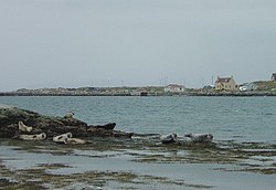 BeàrnaraighIsland · 1.2 mi
 Causeway Opening Commemoration StoneMemorial · 1.8 mi
More historic places in Na h-Eileanan Siar · All of Na h-Eileanan Siar
What do you know about this place?