
What is recorded here
From OpenStreetMap (© OpenStreetMap contributors) w1436582130
Places near here
Photo credits
- Maker not stated on source page, www.dreamstime.com
- Maker not stated on source page, en.wikipedia.org
- Robert Ashby, Wikimedia Commons · CC BY-SA 2.0
- Albert Bridge, Wikimedia Commons · CC BY-SA 2.0
- Maker not stated on source page, www.flickr.com
- Rossographer, Wikimedia Commons · CC BY-SA 2.0
- Maker not stated on source page, www.geograph.ie
- Kenneth Allen, Geograph · CC BY-SA 2.0
- St Michael’s GAC, Magheralin (photo supplied to Armagh I; individual photographer not named), armaghi.com
- Golfing in Ireland; photographer not stated, Source publisher
- Maker not stated on source page, www.pinterest.com
 Enclosure in DrumbaneEnclosure · 1703 yd
Explorer Tom Enclosure in Drumbane is hiding a tunnel to the local pub, according to every legend ever told there. We haven’t found…
 Mound & Rectilinear Earthwork in FeneyMound & Rectilinear Earthwork · 1.0 mi
Explorer Tom Mound & Rectilinear Earthwork in Feney is bragging about surviving a storm that probably didn't even happen, but it…
 Berwick HallHouse · 1.0 mi
Explorer Tom Berwick Hall gave up chocolate for Lent but kept its secrets, which is a shame because it’s got zero patience for…
 Lagan Canal in Magheramesk; Poobles; Lurgansemanus; Killough; Aghagallon; Ballycairn; Drumaleet; Derrynaseer, Aghagallon; Derryhirk; Tiscallen, Aghagallon; Kilmore; Aghalee; Ballycanal; Drumbane; Ballynanaghten; Ballynaghten; TrummeryLagan Canal · 1.1 mi
Explorer Tom The Lagan Canal in Antrim carries a curse that only affects people who don't wave at the passing barges, so keep your…
 Mound (O.S. memoir site, unlocated) in PooblesMound (O.S. memoir site, unlocated) · 1.2 mi
Explorer Tom Mound (O.S. memoir site, Unlocated) in Poobles would post selfies claiming to be a mountain but it’s just a heap of…
 Moira Railway StationRailway Station Structures · 1.3 mi
Explorer Tom Moira Railway Station in Magheramisk, County Antrim, is waiting for a prophecy about a golden train that never actually…
 Magheralin CemeteryCemetery · 1.3 mi
Explorer Tom Magheralin Cemetery has a shortcut that goes straight through the middle and saves exactly zero time, which is the…
 Medieval parish church (site of) & c17th church & graveyard: lan in MagheralinMedieval Parish Church (site of) & C17th Church & Graveyard: Lan · 1.3 mi
Explorer Tom Lan in Magheralin has a medieval parish church site and a 17th-century church, so it’s basically a history lesson with…
 Church, graveyard & holy well (unlocated): st.ronan finn in KilminiogeChurch, Graveyard & Holy Well (unlocated): St.ronan Finn · 1.4 mi
Explorer Tom St. Ronan Finn in Kilminioge is unlocated, which means the Vikings definitely got lost looking for it and blamed bad…
 St. Michael's GAA Ground, St. Michael's GAA, MagheralinGAA ground · 1.8 mi
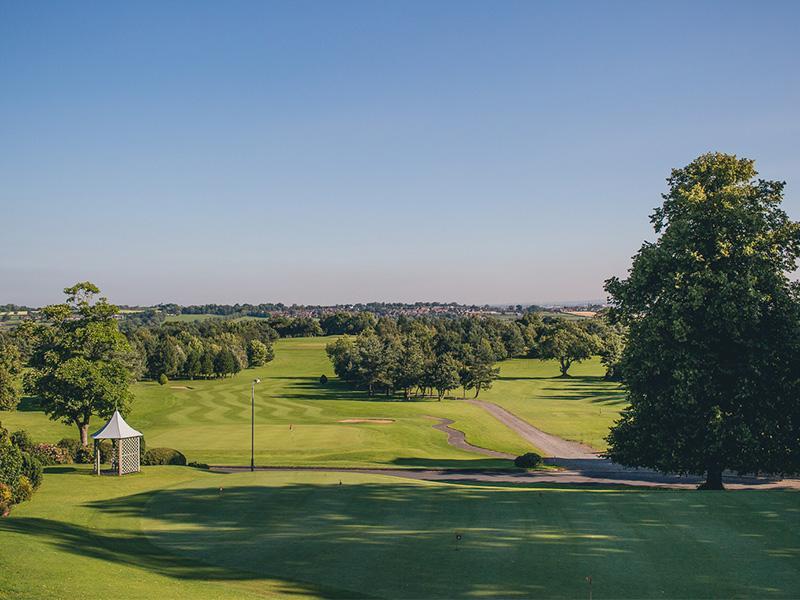 Edenmore Golf ClubGolf course · 1.9 mi
 Well & ?castle in InisloughlinWell & ?castle · 1.9 mi
Explorer Tom Well & ?castle in Inisloughlin is where a well and a castle got into a screaming match. Some local swears he invented…
More archaeology and monuments in County Down · All of County Down

What do you know about this place?Tap to add a comment or ask a question