What is recorded here
From OpenStreetMap (© OpenStreetMap contributors) w311337514
Places near here
Photo credits
- National Inventory of Architectural Heritage
- Mac McCarron, Geograph · CC BY-SA 2.0
- Mhdelaney, Wikimedia Commons · CC BY-SA 4.0
- Bart Whelan, Wikimedia Commons · CC BY-SA 2.0
- Joseph Mischyshyn, Geograph · CC BY-SA 2.0
- Rev. Joseph Turner (circa 1772 date QS:P,+1772-00-00T00:00:00Z/9,P1480,Q5727902 – 1835), Wikimedia Commons · Public domain
- Robert Bone, Wikimedia Commons · CC BY-SA 2.0
- Wanfried-Dublin, Wikimedia Commons · CC BY-SA 4.0
- Kenneth Allen, Geograph · CC BY-SA 2.0
- Rossographer, Geograph · CC BY-SA 2.0
- Anne Burgess, Wikimedia Commons · CC BY-SA 2.0
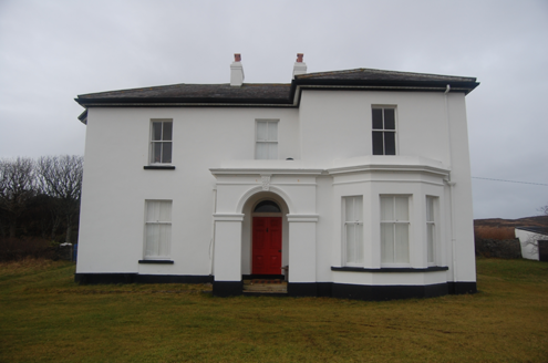 hotel3.1 mi
Explorer Tom Hotel in Middletown was built around 1890, probably for early visitors to the nearby coast. The building survey later recorded it as a private house. I would have guessed 'hotel' meant I could ask for a room, but the name has outstayed the guests.
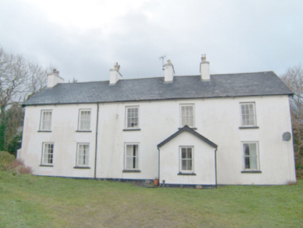 Swan MountHouse · 3.1 mi
Explorer Tom Swan Mount sits right on top of an old village from 1837! I bet the house is still listening to the ghosts of the clachan below whispering about where their tea kettles went. It feels like standing on a giant, very quiet sandwich.
 InishkeelIslet · 3.3 mi
Explorer Tom Inishkeel has old churches and carved cross slabs, which sounds like a fine island hunt to me. Then Heritage Ireland stops me at the first step: it says the island is inaccessible to the public. An old low-tide crossing story is not a current invitation.
 Narin–Portnoo StrandOfficial bathing water · 3.8 mi
Explorer Tom Narin–Portnoo Strand is a cove with grand ambitions: about two kilometres of sand and a dune ridge behind it. Dunmore Head takes some of the Atlantic’s edge, while Inishkeel sits out front like it reserved the best seat. I would keep that island on my map, with the tide as its own boss.
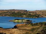 Doon FortFairy fort / stone ringfort · 3.9 mi
Explorer Tom Doon Fort takes up almost the whole small island in Doon Lough. Its wall is four metres thick at the base; the builders did not leave much of that island as spare space.
 Tramore StrandBeach / strand · 4.6 mi
Explorer Tom Rosbeg’s Tramore Strand has a whole sand department working behind it. A geological field guide describes dunes along this open coast and more by the Loughros Mór estuary, as if one set of dunes could not decide where to settle. This is the southern Tramore, not its namesake near Dunfanaghy.
 Kilclooney More Court TombCourt tomb · 5.1 mi
Explorer Tom Kilclooney More Court Tomb was actually drawn by William Burton Conyngham in 1799, back when its lintel was still perfectly in place. Now that massive slab is lying upside down on the floor, which feels like a bit of a letdown. But the old name 'Dermot and Grania's Bed' makes me think it’s all about legends.
 Carrickalahagh HeadlandPublicly named cliff or headland · 5.2 mi
Explorer Tom Carrickalahagh Headland rises boldly from the coastline, its name a local treasure shared through public pictures rather than maps.
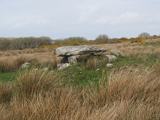 Kilclooney More Portal TombPortal tomb · 5.2 mi
Explorer Tom Kilclooney More Portal Tomb is basically a stone huddle where the portal gets completely swallowed by the side slab. It’s tucked into wet pasture near Loughros More Bay, and Thomas Fagan saw it exactly this way back in 1847. So if you’re expecting grandeur, maybe lower your expectations, but I like its stubborn little posture.
 Strand View BarPub · 5.4 mi
Explorer Tom Strand View Bar probably has a view of the sea and a lot of people staring at it. It's in Donegal, where the wind tries to steal your hat. Go look out the window and feel majestic.
 Bonny Glen Wood - Bonny Glen walkOfficial walking route · 5.7 mi
Explorer Tom This tiny forty-minute forest walk is a lovely way to burn off energy. Let's loop around this managed woodland and spot some wildlife.
 CroaghnamaddyMountain / peak · 6.4 mi
Explorer Tom Croaghnamaddy offers a whole view from County Donegal, a peak that seems to be keeping its secrets very closely.
More islands in County Donegal · All of County Donegal

What do you know about this place?Tap to add a comment or ask a question