
What is recorded here
Located on a fairly level landscape. The cropmark of a circular enclosure (diam. c. 10m) defined by a fosse feature is visible on aerial photograph (CUCAP, BDI 93). The enclosure site (WX048- 040001-) is c. 5m to the E and the enclosure site (WX048-040003-) appears to be attached to the SW. It is not visible at ground level in pasture.
From the National Monuments Service (Archaeological Survey of Ireland) record WX048-040002
Places near here
Picture notes
- Computer-made picture. It does not show this monument.
- National Inventory of Architectural Heritage
- Fran Mr Hollywood, Wikimedia Commons · CC BY-SA 2.0
- Cozzmick, Wikimedia Commons · CC BY-SA 4.0
- Mike Searle, Wikimedia Commons · CC BY-SA 2.0
- Computer-made picture. It does not show this playground.
 Enclosure in RingknockEnclosure · 18 ydComputer-made picture
 Pit in CottsPit · 426 ydComputer-made picture
 Gallain, Ogham StoneStanding stone, pair · 431 ydComputer-made picture
 Fairy fort / earthen ringfort in CottsFairy fort / earthen ringfort · 480 ydComputer-made picture
 Ring-ditch in CottsRing-ditch · 567 ydComputer-made picture
 Inscribed stone in BallymacaneInscribed stone · 613 ydComputer-made picture
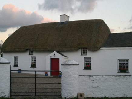 farm house685 yd
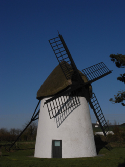 mill (wind)1034 yd
 Tacumshane WindmillVisitor attraction · 1036 yd
 CastleCastle, tower house · 1330 yd
_-_geograph.org.uk_-_3715787.jpg/250px-Castles_of_Leinster,_Ballyhealy,_Wexford_(1)_-_geograph.org.uk_-_3715787.jpg "Photo: Mike Searle, Wikimedia Commons · CC BY-SA 2.0") Castle (in ruins)Castle, tower house · 4.3 mi
Castle (in ruins)Castle, tower house · 4.3 mi Children's playground5.0 miComputer-made picture
More archaeology and monuments in County Wexford · All of County Wexford

What do you know about this place?Tap to add a comment or ask a question