What is recorded here
No human has broken the soil there, yet the ground still holds the shape of two rings and a line of ditches. That much is clear in the aerial picture. The larger ring stands beside its smaller neighbour, and a sequence of fosses stretches through adjacent fields. Whether those marks belong to one moment or several remains unknown. The closeness suggests connection, but distance and time could have stretched them apart. The land kept the shapes long after the hands that made them disappeared.
Aerial photograph (GB89.S.08) shows cropmark of a ring-ditch (one of two adjacent ring-ditches). This is the larger of the two. Sequence of fosses in adjacent fields. Ring-ditches are often found in association with plough-levelled field boundaries. Detailed mapping needed to clarify whether some may be contemporaneous. The closely spaced parallel linear ditches may also be a plough-levelled field boundary.
Bibliography
Barrett, G.F. 'Early landscapes in County Carlow: an aerial perspective, in T. McGrath and T. O'Keefe (eds), County Carlow: History and Society, Geography Publications, Dublin.. Forthcoming 2008.
Barrett , G.F. (2002) 'Flights of discovery: archaeological air survey in Ireland, 1989-2000' in the Journal of Irish Archaeology, XI, 2002., pp. 1-30.
The monument record does not grant public access. Check the route and ask the landowner before entering private land.
- What survives
- Recorded monument
Places near here
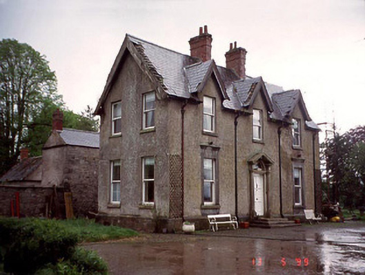 Garryhundon Househouse · 1081 yd
 Enclosure in Oldtown (nurney Ed)Enclosure · 1199 yd
 Enclosure in GarryhundonEnclosure · 1333 yd
 Saint John's Church (Nurney)church/chapel · 1589 yd
 Graveyard in ClonmelshGraveyard · 1.2 mi
 Common LimeCommon Lime · 1.2 mi
 Graveyard in Tomard Lower (3 Detached Portions)Graveyard · 2.2 mi
 Black Castle (in ruins)Castle, tower house · 2.5 mi
 Graiguealug Castle in ruinsCastle, unclassified · 2.8 mi
 Pedunculate OakPedunculate Oak · 3.0 mi
 The Columban WayVisitor information · 4.0 mi
 Lock Keeper's House and Lodge MillsVisitor information · 4.2 mi