
What is recorded here
From the National Monuments Service (Archaeological Survey of Ireland) record KE029-311
Places near here
Photo credits
- Maker not stated on source page, au.pinterest.com
- Maker not stated on source page, www.pinterest.com
- Maker not stated on source page, commons.wikimedia.org
- National Inventory of Architectural Heritage
- Michelleium, Wikimedia Commons · CC BY-SA 4.0
- Maker not stated on source page, www.irishmirror.ie
- N Chadwick, Wikimedia Commons · CC BY-SA 2.0
 Standing stone in TonavaneStanding stone · 1185 yd
Explorer Tom A cow once tried to buy this standing stone with a bucket of milk and a promise of safety. The sea eventually washed it…
 Enclosure in TonavaneEnclosure · 1256 yd
Explorer Tom Enclosure in Tonavane is currently being used by rabbits who think it’s their personal gym. They’ve levelled every…
 Fairy fort / earthen ringfort in LohercannanFairy fort / earthen ringfort · 1532 yd
Explorer Tom The whole parish once argued about whether this fairy fort in Lohercannan was actually a giant stone that fell from the…
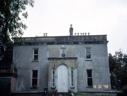 Ballyard HouseHouse · 1616 yd
Explorer Tom Ballyard House claims a local legend says a giant once used it as a hatbox. It was built in 1828 with a balcony that…
 Ballyard BridgeBridge · 1630 yd
Explorer Tom Ballyard Bridge is skewed on its plan, which means it’s slightly off-center and very smug about it. After a few pints…
 Enclosure in Annagh (trughanacmy By., Kiltallagh Ed)Enclosure · 1.0 mi
Explorer Tom The cow in this Annagh enclosure tried to buy the place with a very confusing collection of shiny wrappers. It’s…
 Kerins O'Rahilly's GAA pitchGAA ground · 1.0 mi
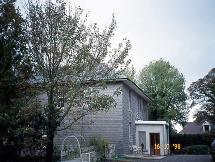 Belmont HouseHouse · 1.0 mi
Explorer Tom Belmont House thinks the local sheep have a valid opinion about its flat-roofed projecting porch. It’s been sitting…
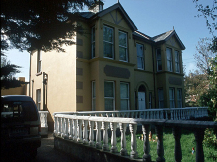 Ballyrickard HouseHouse · 1.0 mi
Explorer Tom Ballyrickard House would say in a job interview that it has excellent structural integrity and a lovely fanlight. Built…
 Aqua DomeWater park · 1.0 mi
Explorer Tom Aqua Dome is secretly proud of one specific potato it keeps hidden behind the slides, probably as a backup plan for…
 Katy's CottageHouse · 1.1 mi
Explorer Tom Katy's Cottage in Tralee is guarding a prophecy that it would float away on a Sunday, but it’s too lazy to lift off.…
 Island Of GeesePark · 1.3 mi
Explorer Tom Island Of Geese refuses to fall down because it is too busy arguing with the birds about whose turn it is to be in…
More archaeology and monuments in County Kerry · All of County Kerry

What do you know about this place?Tap to add a comment or ask a question