
What is recorded here
From the Northern Ireland Sites and Monuments Record record TYR060:045
Places near here
Photo credits
- Maker not stated on source page, www.tripadvisor.ie
- Maker not stated on source page, commons.wikimedia.org
- Kenneth Allen, Geograph · CC BY-SA 2.0
- Kenneth Allen, Wikimedia Commons · CC BY-SA 2.0
- Belfast Telegraph; individual photographer not named in accessible image details, www.belfasttelegraph.co.uk
- Maker not stated on source page, www.youtube.com
- Maker not stated on source page, www.pinterest.com
- We Are Tyrone; individual photographer not named on the article, wearetyrone.com
- National Inventory of Architectural Heritage
- Stefan C. Kremer, Wikimedia Commons · CC BY-SA 3.0
- Maker not stated on source page, www.alamy.com
 Court tomb: horned cairn in GlasdrummondCourt Tomb: Horned Cairn · 1387 yd
Explorer Tom Court tomb: horned cairn in Glasdrummond survived a storm so bad it threw its own stones into the next county. It’s…
 Mapped cemeteryCemetery · 1.3 mi
Explorer Tom Mapped cemetery in County Tyrone is playing hard to get on its dating profile, claiming it’s ‘too mysterious’ and…
 Medieval Parish Church; Graveyard also Site of C13th Battle: Carnteel Church in CarnteelMedieval Parish Church · 1.3 mi
Explorer Tom Medieval Parish Church, Graveyard also Site of C13th Battle: Carnteel Church in Carnteel was saved by a hero so…
 Upper Clonaneese Presbyterian ChurchChurch · 1.4 mi
Explorer Tom Upper Clonaneese Presbyterian Church once hosted a dramatic incident where a sheep wandered in and sat on the organ…
 St. Mary's Park, St. Mary's GAA, KilleeshilGAA ground · 3.1 mi
 Island, possibly crannog: kennedy's island in Killyliss; LegillyIsland, possibly Crannog: Kennedy's Island · 4.1 mi
Explorer Tom Island, Possibly crannog: kennedy's island in Killyliss took about forty cups of tea to build, mostly because everyone…
 Fairy fort / earthen ringfort in Moy (trough By.)Fairy fort / earthen ringfort · 4.5 mi
Explorer Tom Fairy fort / earthen ringfort in Moy’s secret talent is pretending to be a very confused garden bed. It’s densely…
 Fr. Connolly Park, St. Patrick's GAA, EglishGAA ground · 4.6 mi
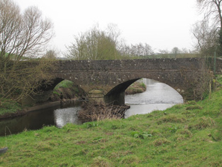 Ravellea BridgeBridge · 4.6 mi
Explorer Tom Ravellea Bridge is standing there on the Blackwater, looking smug because it survived the nineteenth century without a…
 CastlecaufieldCastle · 5.0 mi
Explorer Tom Castlecaufield came this close to making the news but got shy and hid behind some hedgerows. It’s got that look of a…
 C17th house & bawn, possibly on site of earlier fort: castle caulfield in Lisnamonaghan, CastlecaufieldC17th house & bawn, possibly on site of earlier fort: castle caulfield · 5.0 mi
Explorer Tom C17th house & bawn, Possibly on site of earlier fort: castle caulfield in Lisnamonaghan thinks it's better than the…
 Mapped graveyardGraveyard · 5.5 mi
Explorer Tom this Mapped graveyard in County Monaghan has a scandal it’s been hiding for centuries involving a goat, a bishop, and a…
More archaeology and monuments in County Tyrone · All of County Tyrone

What do you know about this place?Tap to add a comment or ask a question