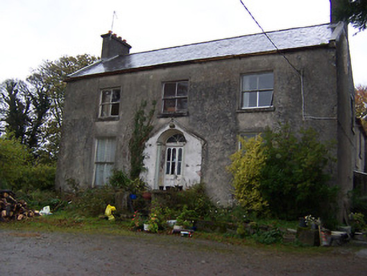
What is recorded here
Detached three-bay two-storey former rectory, built c.1810, having a two-storey return to the rear (north). Previously had a projecting single-bay gable-fronted entrance porch to the centre of the main façade (south), recently removed. Associated with the Church of Ireland church in Tyrrellspass (15322026). Now in use as a private house. Pitched natural slate roof with a raised verge and a rendered chimneystacks to either end (east and west). Projecting eaves course and cast-iron rainwater goods. Lime roughcast rendered walls with square-headed window openings having cut stone sills and two-over-two pane timber sliding sash windows. Round-headed doorcase to the centre of the entrance façade (south) having chamfered surround, glazed timber double-doors and a simple Gothic fanlight over. Flight of cut stone steps gives access to entrance front. Set back from road to the north of Tyrrellspass having main entrance gates (15403322) to the southwest and single-storey outbuildings to the north.
A plain but appealing early nineteenth-century Church of Ireland rectory, which retains its early form, character and a great deal of its early fabric. This building remains of particular importance in the locality for its original use as a Church of Ireland rectory, sponsored by the Board of First Fruits (c.1711-1833). Lewis (1837) records that this rectory was built in 1810 using a loan of £300 and a gift of €400 from the Board of First Fruits. It forms an interesting pair of related structures along with the associated Church of Ireland church (15322026) located in Tyrrellspass to the south. This former rectory represents an interesting historical insight into the social structure in Ireland at the time of construction and is an appealing feature in the landscape to the north of Tyrrellspass. The modest single-storey outbuildings to the rear and the main entrance gates (15403322) to the southwest complete the setting of this unassuming composition.
This does not grant access. Most recorded buildings are privately owned; view them only from public ground unless the owner allows entry.
Places near here
 The Glebedemesne walls/gates/railings · 224 yd
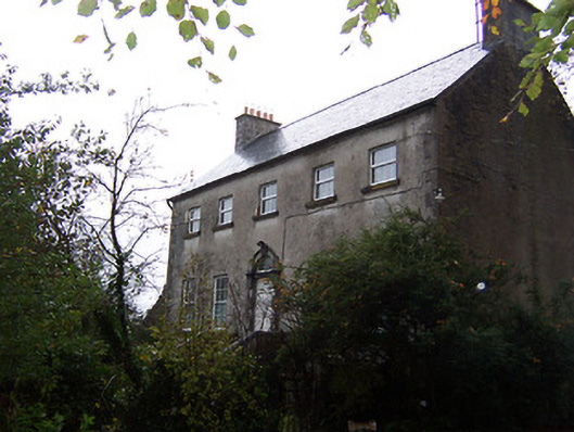 Guilford Housecountry house · 401 yd
 Man-made underground passage in Guilford or DavidstownMan-made underground passage · 753 yd
 Partially hachuredFairy fort / earthen ringfort · 1221 yd
 CastleCastle, hall-house · 1490 yd
 Tyrrellspass CastleCastle, tower house · 1758 yd
 Ardan WoodWood · 3.6 mi
 Bonfire HillMountain / peak · 4.4 mi
 Ash IslandIslet · 5.1 mi
 Croghan HillMountain / peak · 5.8 mi
 Finnrenashark Holy WellSpring · 5.9 mi
 Croghan Hill WalkVisitor information · 6.0 mi
Other information
Photo: National Inventory of Architectural Heritage · Website use allowed for educational or private purposes with source credit