What is recorded here
Half-buried in damp rush pasture on the west bank of a north-west flowing stream, the burnt mound in Rathslevin still holds charcoal-rich soil and heat-darkened stone within its shallow circular body. A field drain now cuts through the middle, exposing the burnt core while cattle traffic and old ridges wear the edge away. Fifty metres north-west, another burnt mound waits in the same low ground, suggesting this was once a busy place for water, heat and repeated human use.
In lowlying, damp rush-grown pasture, located on the W bank of a NNW flowing stream/drain.
Sod-covered, circular mound (12.4m NE–SW; 11.4m NW–SE; H 0.4m), bisected centrally on a NE–SW axis by a field drain (Wth 1.4m at top, 0.8m at base; D 0.4m) which intersects with the stream/drain 3m to NE. Burnt stone in charcoal-rich soil is exposed in the drain section.
The mound is in a rather dilapidated condition. Two shallow linear features, possibly cultivation ridges traverse the NW half of the mound on a NE–SW axis and a cattle track has eroded part of the SW edge of the mound. Another burnt mound (MA071-205----) is located 50m to NNW.
Compiled by: Jane O’Shaughnessy
Date of upload: 27 September 2021
A burnt mound, likely dating to the Bronze Age; its significance lies in its association with domestic or ritual activities, possibly linked to heat-related functions such as cooking or ceremonial practices.
The monument record does not grant public access. Check the route and ask the landowner before entering private land.
- What survives
- Recorded monument
Places near here
 IndicatedFairy fort / earthen ringfort · 770 yd
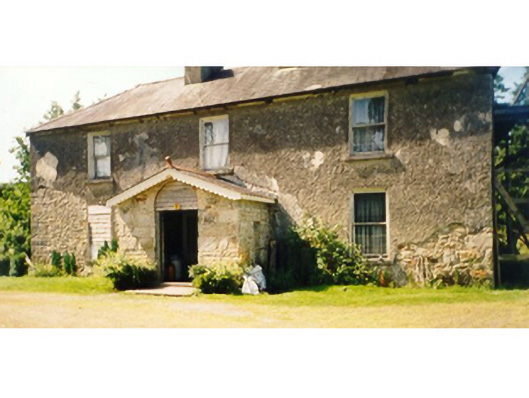 Killedan Housefarm house · 1241 yd
 Killedan ChurchChurch · 1.1 mi
 Enclosure in Clooneen (gallen By.)Enclosure · 2.1 mi
 Thorn CaveCave · 2.3 mi
 I'll Send You The FareMemorial · 2.5 mi
 Kiltimagh MuseumMuseum · 2.7 mi
 Carrowbeg WoodWood · 3.3 mi
 CashlankeeghCastle, unclassified · 3.5 mi
 Shonagawna Castle in RuinsCastle, unclassified · 4.6 mi
 Michael DavittMemorial · 5.0 mi
 Brabazon WoodsForest · 5.3 mi