What is recorded here
Mortons and others climbed the Galmoy ridgeline because the fort still stood above the wet pasture, not buried beneath it. An invisible chest held the climbed world: the Galmoy ridgeline, the Glin valley, the black sea beyond, and the small human bodies that risked the storm to watch them. The Glin valley was not a vague green line; it was a living archive where human and nonhuman events could be compared.
On a natural rise in flat, wet, boggy pasture with a good view across the entire area. Since the monument was inspected in 1987 this and surrounding fields were planted in forestry. A buffer zone was left around the monument. The monument was fairly heavily overgrown with trees and shrubs. A roughly circular raised ringfort (diam. c. 17.5m; H c. 1.4m) with a slight bank (int. H c. 0.2-0.3m) on the outer edge of the platform. The monument has been quarried on its S side. There is no entrance.
Compiled by: Jean Farrelly
Date of upload: 25 September 2017
The monument record does not grant public access. Check the route and ask the landowner before entering private land.
- What survives
- Recorded monument
Places near here
 Castle PierceHouse, fortified house · 500 yd
 Enclosure in GraigueadrislyEnclosure · 940 yd
 Enclosure in BayswellEnclosure · 1145 yd
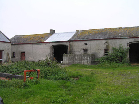 Bayswell Housefarmyard complex · 1180 yd
 IndicatedCastle, ringwork · 1.4 mi
 Erke Churchchurch/chapel · 1.4 mi
 Cnoc SeanrathaMemorial · 2.0 mi
 Tullow HillMountain / peak · 3.5 mi
 Clonmeen WoodWood · 3.9 mi
 DelaneyMemorial · 4.0 mi
 Street fieldArchaeological place · 4.8 mi
 College HillMountain / peak · 9.1 mi