What is recorded here
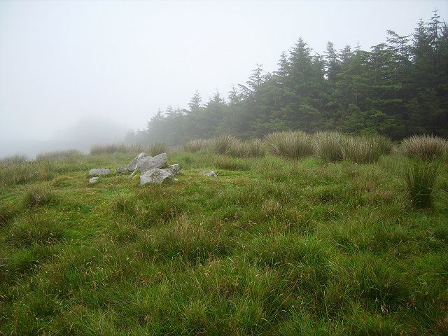
Gallauns is a small unclassified cairn on the north bank of the Mile Water River in County Cork, Ireland. Six stones form its south kerb, while loose stones inside the arc may be disturbed cairn material. It sits beside a stone row in pasture, preserving a quiet marker of human activity along the river.
In pasture on N bank of Mile Water River, 2m to N of stone row (CO131-008002-). Arc of 6 stones averaging (H 0.25m; L 0.7m; Wth 0.6m) forms S kerb of cairn. According to O Nualláin (1988, 237) some loose stones within arc may be disturbed cairn material.
The above description is derived from the published 'Archaeological Inventory of County Cork. Volume 1: West Cork' (Dublin: Stationery Office, 1992). In certain instances the entries have been revised and updated in the light of recent research.
Date of upload/revision: 14 January 2009
A Neolithic cairn with a stone kerb; likely dates to the Early to Middle Neolithic period. Its association with a nearby stone row suggests ritual or ceremonial significance in a prehistoric landscape.
The monument record does not grant public access. Check the route and ask the landowner before entering private land.
- What survives
- Recorded monument
Places near here
 Durrus Church (in Ruins)Church · 514 yd
 Ardrah FortFairy fort / earthen ringfort · 1400 yd
 Letterlicky FortFairy fort / earthen ringfort · 1575 yd
 Scart Castle (Site of)Castle, unclassified · 1.2 mi
 farm housefarm house · 1.2 mi
 Barnageehy Loop WalkWalking route · 1.6 mi
 Derrylahard EastMountain / peak · 1.8 mi
 Seskin ViewViewpoint · 2.0 mi
 KnockboolteenaghMountain / peak · 2.3 mi
 GinkgoGinkgo · 2.5 mi
 Bantry HouseHeritage attraction · 2.7 mi
 Tourist OfficeVisitor information · 2.9 mi