What is recorded here
Fairy fort / earthen ringfort in Magheragillerneeve OR Springfield is a fairy fort or earthen ringfort in Magheragillerneeve OR Springfield, County Sligo, Ireland. The site occupies a slight rise behind a modern house and preserves a crescentic raised area measuring 26 metres east west and 16 metres north south. A narrow earth and stone bank, 5.2 metres wide and 0.4 metre high internally, encloses the remaining section. The northwest and eastern bank has been removed to leave a scarp, while the southeast and west southwest area has been levelled until no surface trace remains.
Situated on a slight rise, in rear garden of modern house. Crescentic raised area (dims. 26m E-W; 16m N-S) enclosed by a narrow bank of earth and stone (Wth 5.2m; int. H 0.4m). There is no fosse visible at ground level. The bank has been removed NW-E and the site is defined by a scarp. From SE-WSW the site, originally circular, has been levelled and no surface trace is visible at ground level. The original entrance is not recognisable.
Compiled by: Patrick F. O'Donovan
Date of upload: 21 April 2011
This remains an important historical record, but the official description says the monument is no longer visible or has been destroyed. The monument record does not grant public access. Check the route and ask the landowner before entering private land.
- What survives
- No visible remains or recorded as destroyed
Places near here
 Enclosure in Magheragillerneeve OR SpringfieldEnclosure · 400 yd
 IndicatedFairy fort / earthen ringfort · 605 yd
 Flour millMill, unclassified · 613 yd
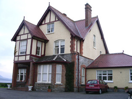 Rossavillehouse · 1284 yd
 Drumcliff CemeteryGraveyard · 1.5 mi
 Grave of WB YeatsHeritage attraction · 1.5 mi
 CastleCastle, unclassified · 1.8 mi
 European BeechEuropean Beech · 2.1 mi
 Castle (in Ruins)Castle, unclassified · 2.7 mi
 Floods WoodForest · 2.9 mi
 Kings MountainMountain / peak · 3.1 mi
 Finned PointHeadland · 3.1 mi