
What is recorded here
Knockaskeheen Caher was a stone ringfort on a green knoll in County Clare, visible on the 1842 map but completely demolished by 1905. It vanished so thoroughly that Westropp could find no trace where it stood, leaving behind only an empty pasture and a name preserved in ink. The loss is absolute, yet the sharp southern view remains, waiting for someone to imagine the walls that once cut the horizon.
On a knoll in hilly pastureland with good views to the S. Hachured and labelled 'Knockaskeheen Caher' on the 1842 ed. of the OS 6-inch map. Recorded by Westropp (1905, 352) as being ‘so completely demolished since 1839 that no trace can be found on the green knoll where it once stood’. No visible surface trace survives.
Compiled by: Olive Alcock and Conn Herriott
Date of upload: 27 September 2022
The monument record does not grant public access. Check the route and ask the landowner before entering private land.
- What survives
- Recorded monument
Places near here
 Spectacle Bridgebridge · 693 yd
 IndicatedFairy fort / earthen ringfort · 1517 yd
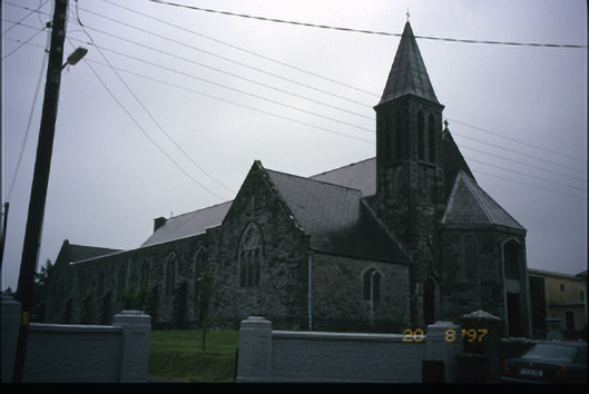 Corpus Christi Catholic Churchchurch/chapel · 1598 yd
 Enclosure in Ballydonohoe (burren By.)Enclosure · 1.4 mi
 St. Catherine's OneCave · 1.5 mi
 Ballinalacken CastleCastle · 1.5 mi
 Doolin CaveCave · 1.6 mi
 Doolin Cave Visitor CentreHeritage attraction · 1.6 mi
 Ballyteigue Nature ReserveNature reserve · 1.9 mi
 Site of Lisdoonvarna CastleCastle, tower house · 1.9 mi
 OughtdarraCliff · 3.0 mi
 The BurrenHeritage attraction · 3.0 mi
Other information
Photo: Credit not shown in the picture search · Rights wording not checked; contact us if this picture should be removed