What is recorded here
Grave Yard stands in gently undulating grassland northeast of Kiltullagh village, holding four medieval graveslabs beside hundreds of later headstones. The ruined church at its south end and a lone font suggest worship continued long after the building fell, while the modern stone wall marks where memory still belongs. People may have walked this place for centuries, carrying grief, pride or quiet love into soil that never stopped receiving them.
In gently undulating grassland to the NE of Kiltullagh village. This rectilinear graveyard (c. 90m NE-SW; c. 86m NW-SE) is enclosed by a modern stone wall. Access is gained via a gateway at S. Most of the headstones date from the 18th to the 20th centuries but four medieval graveslabs (GA097-114003- to GA097-114006-) are also visible. The remains of a church (GA097-114----) occupy its S end and a font (GA097-114002-) in its SW sector probably came from the church.
Compiled by: Olive Alcock
Date of upload: 11 March 2020
The monument record does not grant public access. Check the route and ask the landowner before entering private land.
- What survives
- Recorded monument
Places near here
 Font in Kiltullagh NorthFont · 5 yd
 Kiltullagh Housecountry house · 150 yd
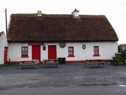 B. Wardhouse · 489 yd
 IndicatedHoly well · 832 yd
 Castle (in ruins)Castle, tower house · 1.1 mi
 MoteCastle, motte and bailey · 1.5 mi
 Moyard WoodWood · 2.9 mi
 Turoe StoneHeritage attraction · 3.8 mi
 Athenry AbbeyHeritage attraction · 4.4 mi
 Horse-chestnutHorse-chestnut · 4.7 mi
 First Battle of Athenrybattle · 4.9 mi
 Barrack IslandIslet · 6.3 mi