Places near here
Photo credits
- National Inventory of Architectural Heritage
- Mike Searle, Wikimedia Commons · CC BY-SA 2.0
- Andreas F. Borchert, Wikimedia Commons · CC BY-SA 4.0
- Rryswny, Wikimedia Commons · CC BY-SA 4.0
- Graham Horn, Geograph · CC BY-SA 2.0
- Stephan van Helden, Wikimedia Commons · CC BY-SA 4.0
- Ingo Mehling, Wikimedia Commons · CC BY-SA 3.0
 Ratty's BridgeBridge · 1003 yd
Explorer Tom Ratty's Bridge in Rathgorgin would win a county fair for best dressed stone structure if there was such a category. The rusticated voussoirs are fancy enough to make the other bridges jealous of their plainness. Look for the ghost, then pretend you didn't see it.
 Hollypark HouseDemesne walls/gates/railings · 1396 yd
Explorer Tom Hollypark House walls in Hollypark refuse to fall down because they’re holding a grudge against gravity. The ashlar piers are just showing off their fancy math skills. Practise your Irish on it, it wants to hear perfect vowels.
_-_geograph.org.uk_-_4070861.jpg/250px-Castles_of_Connacht,_Moyode,_Galway_(2)_-_geograph.org.uk_-_4070861.jpg "Photo: Mike Searle, Wikimedia Commons · CC BY-SA 2.0") Moyode CastleCastle · 1.3 mi
Moyode CastleCastle · 1.3 miExplorer Tom Moyode Castle in County Galway is stuck in a bitter feud with its neighbouring fields over who actually owns the best view of the sunset. It’s been shouting about this for generations and nobody has bothered to check which side is legally correct yet. Stand on the spot and imagine the gossip it's heard.
Moyard WoodWood · 1.5 miExplorer Tom Moyard Wood would tell a teenager that the 1800s were basically just a really long, damp episode of Game of Thrones with worse lighting. The pines are still trying to recover from all that dramatic plotting. Bring biscuits, every good story needs biscuits.
_-_geograph.org.uk_-_5829605.jpg/250px-Castles_of_Connacht,_Dunsandle,_Galway_(1)_-_geograph.org.uk_-_5829605.jpg "Photo: Mike Searle, Wikimedia Commons · CC BY-SA 2.0") Castle (in ruins)Castle, tower house · 1.8 mi
Castle (in ruins)Castle, tower house · 1.8 miExplorer Tom Castle at Dunsandle is playing hard to get. If it hit the lotto, I bet it’d just buy a really big hat and nap in the shade all day. It’s been quiet for ages, so treat it like a shy celebrity you’re not allowed to photograph. Take the long way round, it deserves the effort.
 Athenry AbbeyHeritage attraction · 3.7 mi
Explorer Tom Athenry Abbey in County Galway was built by a giant who just wanted somewhere to store his extra socks. The monks were too polite to ask him to move out later. Have a nosey, politely.
 IndicatedTown defences · 3.8 mi
Explorer Tom Town defences in Athenry are just the bones of what used to keep people out or in. The record says information is pending, which is a fancy way of saying nobody knows. Linger, it's not going anywhere and neither should you.
 Athenry CastleHeritage attraction · 3.8 mi
Explorer Tom Athenry Castle in County Galway is the favorite gossip spot for the local seagulls, who complain about the fish supply daily. They’ve been doing this since before your grandparents were born. Best visited with a curious kid and no timetable.
 Check mapCross, Market cross · 3.8 mi
Explorer Tom Check map in Athenry is actually a late fifteenth-century market cross in the town square. It’s been watching people haggle for centuries while pretending it doesn’t care about prices. Pretend it's yours and plan the housewarming party with local vendors.
 Horse-chestnut4.0 mi
Explorer Tom Horse-chestnut in County Galway ended up here because someone planted the wrong seed and then just left it alone for a century. It’s confused about its identity, so look for the ghost that supposedly haunts its branches, then pretend you didn't see anything at all.
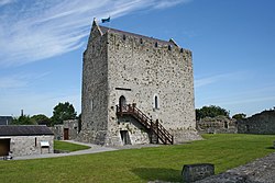 First Battle of AthenryBattle · 4.4 mi
Explorer Tom The First Battle of Athenry involved a cow that tried to buy its way out with milk. History is mostly made up by people who were hungry. Pick a stone, any stone, and invent its biography.
Blake's IslandIslet · 6.1 miExplorer Tom Blake's Island was where a priest lost a massive bet about whether the tide would turn left or right. He owes it a pint forever, so it looks permanently disappointed by human reliability. Look for the ghost, then pretend you didn't see him lurking in the shadows behind you.
More castles and forts in County Galway · All of County Galway

What do you know about this place?Tap to add a comment or ask a question