What is recorded here
Fairy fort / earthen ringfort in Kilmacnevan is a fairy fort or earthen ringfort in Kilmacnevan, County Westmeath, Ireland. The site occupies a slight natural rise surrounded by gently undulating grassland, offering good views to the south and west. A circular area with a north-south diameter of approximately 26 metres is enclosed by two poorly preserved earthen banks with a wide flat-bottomed fosse between them. The inner bank is best preserved at the north and is levelled from the southwest through the west, featuring traces of dry stone walling on both its inner and outer faces.
Situated on a slight natural rise surrounded by gently undulating grassland with good views to the S & W. Levelled ringfort (WM010-038----) 75m to W. A circular shaped area (approx. diam. 26m N-S) enclosed by two poorly preserved earthen banks and intervening wide flat-bottomed fosse. The inner bank is best preserved at N, and is levelled from SW-W. It has traces of dry stone walling on both its inner and outer faces. A sub-circular shaped hut site (WM010-039001-) is visible in the NE quadrant of the monument.
See attached profile of monument surveyed and drawn by the ASI.
Compiled by: Frank Coyne and Caimin O'Brien
Date of upload: 9 June 2017
The monument record does not grant public access. Check the route and ask the landowner before entering private land.
- What survives
- Recorded monument
Places near here
 CastleCastle, unclassified · 190 yd
 Hut site in BallintueHut site · 709 yd
 Church (in Ruins)Church · 919 yd
 CrossCross, High cross · 932 yd
 Site of CastleCastle, unclassified · 1168 yd
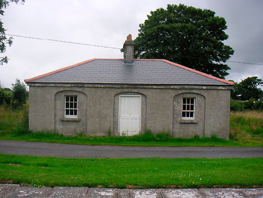 35th Locklock keeper's house · 1178 yd
 Baronstown ForestWood · 2.4 mi
 Horse-chestnutHorse-chestnut · 2.4 mi
 Abbeyshrule AbbeyRuins · 4.9 mi
 Newcastle WoodsForest · 7.6 mi
 Noughaval CemeteryArchaeological place · 10 mi
 National Famine WayWalking route · 11 mi