What is recorded here
Killinure House is a late 18th-century country house on the south end of Lough Ree that absorbed walls from a medieval castle belonging to George Fitzgerald, 16th Earl of Kildare. The castle appeared on the 1653-9 Down Survey maps of Bunowen parish, and a small portion still stood beside the house in 1837. The house overlooks Killinure bay, while Bunowen church and castle sit nearby across the fields. It may still hold stone taken from the older fortress, giving its rooms a buried depth beneath their polished hotel and golf clubhouse use.
Killinure house was built in the late 18th century incorporating part of the medieval castle of Killinure which is depicted on the 1653-9 Down Survey maps of Bunowen parish and the barony map of Kilkenny West (NLI, MS 723-4). The medieval castle stood on the lands belonging to George Fitzgerald, 16th Earl of Kildare. The terrier of the Down Survey map of Bunowen parish stated that on the ‘Landes of Killenure Standes a Castle’ (ibid.). In 1837 it was recorded that a 'small portion of Killinure castle still remains, occupying a site on a bold and picturesque eminence over the Inner Lake, and adjoining Killinure House' (Lewis 1837, 205). Killinure House stands on elevated land overlooking Killinure bay 350m to SSE at the S end of Lough Ree. Bunowen church (WM022-031001-) and graveyard (WM022-031001-) lies 1km to the SE and Bunowen Castle (WM022-022---) stands 1.7km to ENE.
Killinure House described by the National Inventory of Architectural Heritage (NIAH) as a, ‘Detached seven-bay two-storey country house, built c.1790, having a projecting Doric porch to the centre of the front façade (south) and full height three-bay bows to either end of the front façade (east and west). Now in use as a hotel and as a golf clubhouse and extended to the rear (north) and to the northeast and southeast. Set back from road in own grounds, now a golf course, overlooking Killinure Lough/Lough Ree to the south. Original main entrance to the north, now out of use. Modern entrance to the northeast. The present house (Reg. No. 15402209) occupies the site of an earlier castle at Killinure indicated on the Down Survey map of the area, c.1656-8, it is possible that it contains fabric from this earlier structure’ (www.buildingsofireland.ie).
Compiled by: Caimin O’Brien
Date of upload: 22 December 2017
Killinure House was built in the late 18th century on the site of a medieval castle that was recorded in the 1653-9 Down Survey, indicating its long-standing historical presence in the area. It is remembered for its architectural reuse of earlier medieval structures and its association with Bunowen parish and the barony of Kilkenny West.
The monument record does not grant public access. Check the route and ask the landowner before entering private land.
- What survives
- Recorded monument
Places near here
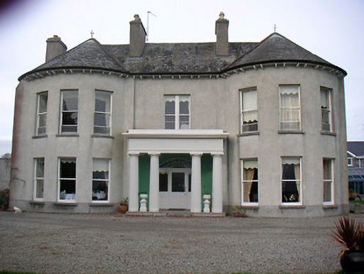 Killinure Housecountry house · 6 yd
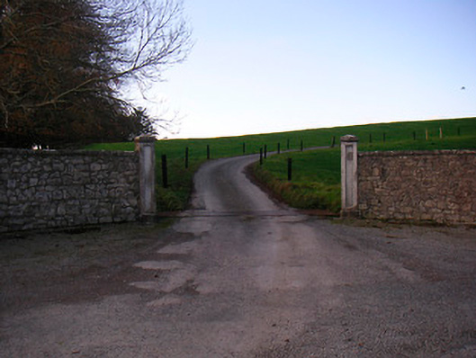 Lough Ree Lodgedemesne walls/gates/railings · 427 yd
 Killinure BayBay · 728 yd
 Lady WellHoly well · 937 yd
 Crannells NookBay · 1034 yd
 OutlinedFairy fort / earthen ringfort · 1629 yd
 Temple's IslandIslet · 1701 yd
 Bunown CastleCastle · 1.1 mi
 HareislandIslet · 1.3 mi
 Portlick Millennium ForestWood · 1.4 mi
 Ballynakill CastleCastle · 1.8 mi
 Siege of Athlonesiege · 3.5 mi