
What is recorded here
Situated on a low ridge of rock outcrop surrounded by poorly drained land which is liable to flooding. Bog land 500m to the S and SW, stream marking boundary with county Longford 280m to W. Ringfort (WM005-013----) 150m to ESE, ringfort (WM005-015----) 160m to S and possible hut site (WM005-012----) 45m to SSW. In the SW quadrant of the ringfort (WM005-011---) are the remains of a circular-shaped grass-covered mound, possibly rock outcrop. There is a smaller irregular mound of earth and stone on the top of this mound which probably represents a collapsed house site (WM005-011001-). The grass-covered wall footings of a rectangular shaped structure located W of centre appears to overlie the enclosing bank of the ringfort and is probably a later house site of unknown antiquity. Its W side is open. Its N wall extends to the upper edge of the ringfort scarp.
Compiled by: Frank Coyne & Caimin O'Brien
Date of upload: 20 December 2016
The monument record does not grant public access. Check the route and ask the landowner before entering private land.
- What survives
- Recorded monument
Places near here
 Hut site in BallygarveyHut site · 10 yd
 Dotted outlineFairy fort / earthen ringfort · 227 yd
 Site of CastleCastle, unclassified · 1368 yd
 Church in RathaspickChurch · 1413 yd
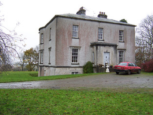 Crumlin Housecountry house · 1440 yd
 Sweet ChestnutSweet Chestnut · 1526 yd
 OutlinedBawn · 1.3 mi
 ShawbrookForest · 1.6 mi
 Edgeworthstown BypassMemorial · 4.8 mi
 Abbeyshrule AbbeyRuins · 5.3 mi
 Saint Mel's CathedralCathedral · 12 mi
 First World War MemorialMemorial · 12 mi
Other information
Photo: Credit not shown in the picture search · Rights wording not checked; contact us if this picture should be removed