What is recorded here
Fairy fort / earthen ringfort in Granardkill is a circular earthwork on a SW-facing pasture slope in County Longford, Ireland. Its raised center measures 34 metres across, bounded partly by a low stone-and-earth bank 5.2 to 6.5 metres wide and 0.3 to 0.95 metres high, and partly by a 1.55-metre scarp. A shallow 6.2-metre-wide fosse appears at NE and SW, with a possible outer bank at NE. A 1975 report suggested the entrance may have faced SE.
On a SW-facing slope in pasture. A raised circular area (diam. 34m) enclosed from WNW-N-WSW by a low bank of earth and stone (Wth 5.2-6.5m; H 0.3-0.95m) and elsewhere defined by a scarp (H 1.55m). A shallow intervening fosse (Wth 6.2m; D 0.1-0.3m) is visible at NE and SW and at NE a possible outer bank (Wth 4.5m; H 0.3-0.4m). A report in 1975 (SMR file) recorded that the original entrance may have been at SE.
Compiled by: Patrick F. O'Donovan
Date of upload: 15 November 2012
The monument record does not grant public access. Check the route and ask the landowner before entering private land.
- What survives
- Recorded monument
Places near here
 Site of Old Town of GranardSettlement deserted, medieval · 564 yd
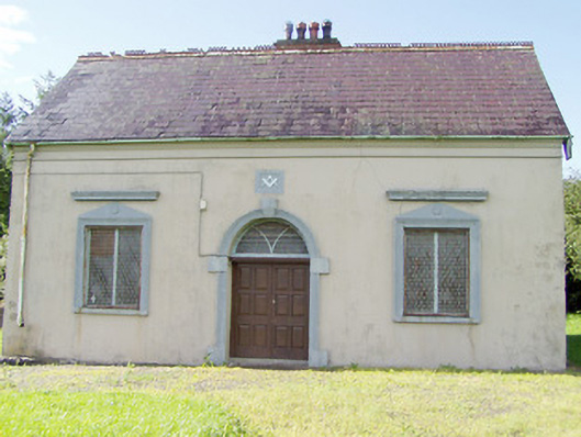 Granard Masonic Hallmasonic lodge/hall · 645 yd
 Church in GranardkillChurch · 742 yd
 St. Patricks WellHoly well · 1077 yd
 CastleCastle, unclassified · 1146 yd
 Moat of GranardCastle, motte and bailey · 1152 yd
 Granard MotteMotte-and-bailey castle remains · 1154 yd
 1798 Monumentmonument · 1263 yd
 Clonfin Ambush MemorialMemorial · 3.0 mi
 Cloonfin WoodForest · 3.2 mi
 CartronfreeMountain / peak · 3.5 mi
 Derrycassan WoodsWood · 3.6 mi