What is recorded here
Oughtagh holds a broken circular rath twenty-six metres wide, its earthen bank gapped and scarped while field boundaries still radiate outward like spokes from a hidden wheel. The fort overlookes a western bog, suggesting people once valued the view or the drain more than they valued the memory of its own walls. What is missing has not stopped the land from arranging itself around the shape.
In grassland overlooking a bog to W. Poorly preserved circular rath (D 26.5m) defined by a denuded bank and external fosse. The bank is present from NNW through E to S; elsewhere a degraded scarp forms the enclosing element. The numerous gaps in the bank all appear modern. Field boundaries radiate from the monument at E and SW. An earthwork (GA007-108----) lies immediately to E.
The above description is derived from the published 'Archaeological Inventory of County Galway Vol. II - North Galway'. Compiled by Olive Alcock, Kathy de hÓra and Paul Gosling (Dublin: Stationery Office, 1999).
Date of upload: 05 August 2010
The monument record does not grant public access. Check the route and ask the landowner before entering private land.
- What survives
- Recorded monument
Places near here
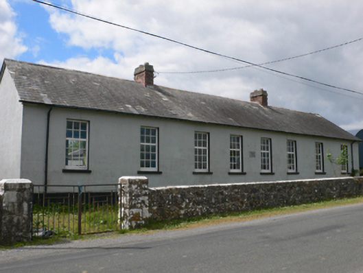 Toberroe National Schoolschool · 829 yd
 Ardagh Ho.House, 18th/19th century · 1356 yd
 Enclosure in Ardagh (ballymoe By.)Enclosure · 1613 yd
 Enclosure in Newtown (ballymoe By.)Enclosure · 1669 yd
 Site of Killomaine Grave YardArchaeological place · 1.3 mi
_-_geograph.org.uk_-_1952978.jpg?width=1280) Bawn in Glinsk (ballymoe By.)Bawn · 1.8 mi
Bawn in Glinsk (ballymoe By.)Bawn · 1.8 mi Rook HillMountain / peak · 2.8 mi
 Site of Ballyglass CastleCastle, unclassified · 2.8 mi
 HawthornHawthorn · 5.8 mi
 Mount MaryMountain / peak · 6.2 mi
 European ashEuropean ash · 7.7 mi
 Sally IslandIslet · 8.0 mi