What is recorded here
In improved pasture, on highest part of field. Circular area (dims. 29m N-S; 27m E-W) defined by bank (overall Wth 8.9m; Wth at top 1.25m; int. H 0.85m; ext. H 1.45m) of earth and stone. Frequent loose limestones on bank and also imbedded within it. Gap (Wth 5m) at NNE and gap (overall Wth 7m; basal Wth 3.5m) at SE. Fosse (overall Wth 8.25m; basal Wth 3.5m; D 0.15m) S-SSW and NW-N. Interior is uneven and has occasional medium-to-large sized stones (L 0.2-0.4m) lying loosely across surface. Ringfort (TS061-103----) is c. 90m to W.
Compiled by: Jean Farrelly
Date of upload: 26 August 2011
A fairy fort or earthen ringfort in Kilconnell, likely dating to the early medieval period, is a circular earthwork with a prominent bank and ditch, typical of defensive or ritual sites from that era. Local tradition associates such mounds with fairy dwellings, reflecting the enduring folklore surrounding these ancient monuments.
The monument record does not grant public access. Check the route and ask the landowner before entering private land.
- What survives
- Recorded monument
Places near here
 Enclosure in KilsallaghEnclosure · 546 yd
 Enclosure in KilconnellEnclosure · 592 yd
 Kilconnell Church (in ruins)Church · 842 yd
 IndicatedBawn · 895 yd
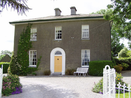 Sandygrove Househouse · 1296 yd
 Bawn in Ballyduagh (railstown Par.)Bawn · 1.3 mi
 Ballyknock HillMountain / peak · 3.4 mi
 Cashel Folk MusuemMuseum · 3.7 mi
 Black mulberryBlack mulberry · 3.7 mi
 The Rock Of CashelVisitor information · 3.8 mi
 Cormac's ChapelHeritage attraction · 3.8 mi
 European YewEuropean Yew · 5.3 mi