What is recorded here
Fairy fort / earthen ringfort in Ballyouragan is a circular earthwork about twenty-six metres across, with a scarped edge and shallow outer ditch, set on a slight slope above the River Maigue. It appeared on maps only after 1840, suggesting people overlooked or forgot it for decades. The clear interior and unbroken rim imply it stood as a marker, shelter or boundary long before surveyors gave it a shape.
In pasture on a slight NNE-facing slope, with moderate to good views in all directions. On the demesne lands of Caherass House 590m to SW. Located 500m NE of the River Maigue and the townland boundary with Ballynahown. Mound (LI021-094----) 85m to N. Not depicted on the 1840 ed. OSi 6-inch map. Shown as a circular earthwork or platform (ext. diam. 26m N-S; 25m E-W) with a scarped edge on the 1897 ed. OSi 25-inch map. Inspected by the ASI in 2000 when it was described as a raised roughly circular-shaped area (int. diam. 23m N-S; 24m E-W) defined by an earthen scarped edge with external fosse (Wth 6.6m; int. D 0.5m; ext. D 0.2m). The interior slopes slightly to the N, is dry and clear of overgrowth. Monument clearly visible on Google Earth orthoimages taken 28/06/2018 and 14/02/2020.
See attached sketch plan surveyed and drawn by the ASI and Google Earth orthoimages
Compiled by: Edmond O’Donovan
Date of upload: 16 August 2020
The monument record does not grant public access. Check the route and ask the landowner before entering private land.
- What survives
- Recorded monument
Places near here
 BarrowBarrow, mound barrow · 124 yd
 Old MillMill, unclassified · 556 yd
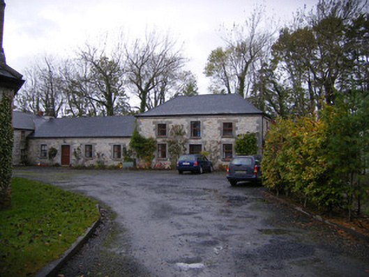 Caherass Houseoutbuilding · 660 yd
 IndicatedEnclosure · 1009 yd
 Fanningstown Castle (in ruins)Castle, tower house · 1.0 mi
 Biodiversity in the Maigue CatchmentVisitor information · 1.1 mi
 CastleCastle, Anglo-Norman masonry castle · 1.3 mi
 Dysert AenghusaHeritage attraction · 1.3 mi
 European ashEuropean ash · 1.8 mi
 Monasteranenagh AbbeyHeritage attraction · 2.9 mi
 GinkgoGinkgo · 2.9 mi
 Kinnoor WellSpring · 3.0 mi