
What is recorded here
In level wet pasture with poor views in all directions. Located 600m NE of the River Maigue and the townland boundary with Ballynahown. On the demesne lands of Caherass House located 625m to SW. Woodland plantation annotated 'Brickfield Wood' shown on Cassini OSi 6-inch map 20m to W. Ringfort (LI021-093----) 85m to S. The site is first depicted as a small scarped mound on the 1897 ed. OSi 25-inch map (ext. diam. 13m N-S; 15m E-W). Inspected by the ASI in 2000 when it was described as a roughly circular-shaped earthen mound (int. diam. 10m) defined by a scarped edge with external fosse (Wth 9m; base Wth 3.5m; int. D 0.65m; ext. D 0.2m). The mound is highest on N side where it survives as a D-shaped mound tapering gently to the S and more steeply to the N. The fosse is wider and better preserved at the N that at the S side. The monument is clearly visible on Google Earth orthoimages taken 28/06/2018 and 14/02/2020.
See attached sketch plan surveyed and drawn by the ASI and Google Earth orthoimages
Compiled by: Edmond O’Donovan
Date of upload: 16 August 2020
A local ancient tomb; wider significance not recorded.
The monument record does not grant public access. Check the route and ask the landowner before entering private land.
- What survives
- Recorded monument
Places near here
 Old MillMill, unclassified · 533 yd
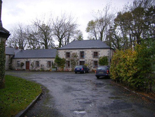 Caherass Houseoutbuilding · 686 yd
 IndicatedEnclosure · 914 yd
 Burnt spread in CroomBurnt spread · 1330 yd
 Fanningstown Castle (in ruins)Castle, tower house · 1717 yd
 Biodiversity in the Maigue CatchmentVisitor information · 1.1 mi
 CastleCastle, Anglo-Norman masonry castle · 1.3 mi
 Dysert AenghusaHeritage attraction · 1.4 mi
 European ashEuropean ash · 1.8 mi
 GinkgoGinkgo · 2.9 mi
 Monasteranenagh AbbeyHeritage attraction · 2.9 mi
 Kinnoor WellSpring · 3.1 mi
Other information
Photo: Credit not shown in the picture search · Rights wording not checked; contact us if this picture should be removed