What is recorded here
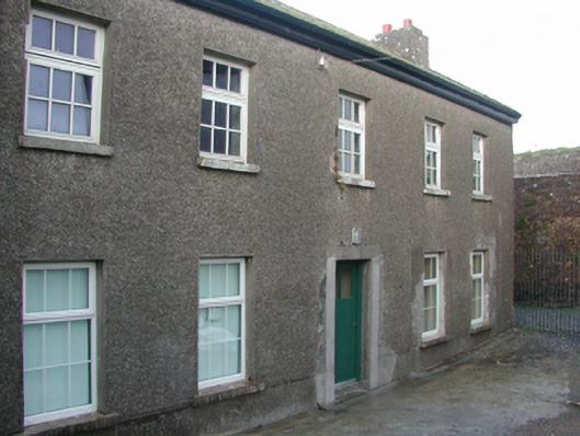
Detached five-bay two-storey barrack store, extant 1840, on a symmetrical plan. Occupied, 1901. Vacant, 1911. Burnt, 1922. In ruins, 1933. Reconstructed, 1939. Vacated, 1986. Renovated, ----, to accommodate alternative use. Now disused. Pitched slate roof with lichen-spotted concrete ridge tiles, lichen-spotted coping to gables with rendered chimney stacks to apexes having stepped capping supporting terracotta pots, and replacement uPVC rainwater goods on eaves boards on roughcast eaves. Roughcast walls on rendered plinth. Square-headed central door opening with rendered "bas-relief" surround framing glazed timber boarded door. Square-headed window openings with concrete or cut-granite sills, and concealed red brick block-and-start surrounds framing replacement casement windows. Set in shared grounds including relandscaped parade ground.
A barrack store contributing positively to the group and setting values of the Duncannon Fort complex with the architectural value of the composition suggested by such attributes as the compact symmetrical footprint centred on a somewhat featureless doorcase; and the diminishing in scale of the openings on each floor producing a graduated visual impression: meanwhile, aspects of the composition clearly illustrate the near-total reconstruction of the barrack store at the outbreak of "The Emergency" (1939-46). Having been well maintained, the form and massing survive intact together with quantities of the original fabric, both to the exterior and to the restrained interior: however, the introduction of replacement fittings to most of the openings has not had a beneficial impact on the character or integrity of a barrack store forming part of a self-contained ensemble making a dramatic visual statement overlooking Waterford Harbour.
This does not grant access. Most recorded buildings are privately owned; view them only from public ground unless the owner allows entry.
Places near here
 pier/jettypier/jetty · 105 yd
 Duncannon Fort LighthouseLighthouse · 115 yd
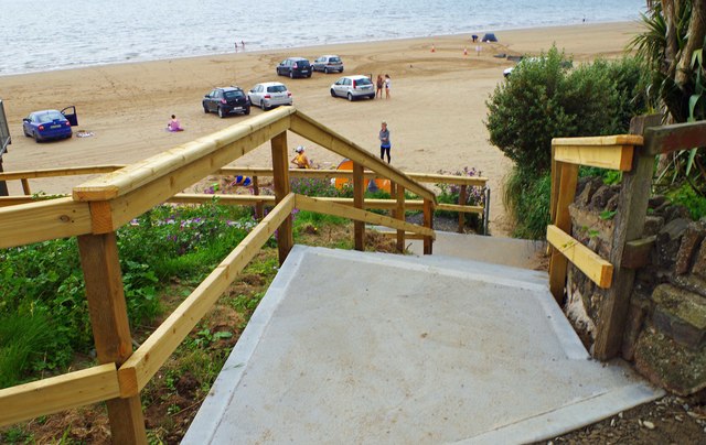 Duncannon BeachVisitor information · 247 yd
 DuncannonBeach / strand · 640 yd
 Enclosure in MersheenEnclosure · 1328 yd
 Enclosure in BallystrawEnclosure · 1.1 mi
 Common WhitebeamCommon Whitebeam · 1.5 mi
 Arthurstown BeachBeach / strand · 1.6 mi
 Carricjmore CliffCliff · 1.7 mi
 Newtown HeadHeadland · 1.7 mi
 Ivory MemorialMemorial · 1.8 mi
 Castle (in ruins)Castle, tower house · 1.9 mi
Other information
Photo: National Inventory of Architectural Heritage · Website use allowed for educational or private purposes with source credit