What is recorded here
Fairy fort / earthen ringfort in Derrysallagh is a fairy fort or earthen ringfort in Derrysallagh, County Sligo, Ireland. It occupies rough pasture on the southeast end of a drumlin and contains a roughly circular area twenty-three by nineteen point two metres. An earthen bank two point four metres wide defines the perimeter, while an external fosse two point four metres wide and zero point four metre deep remains visible along the western arc.
In rough pasture, on the SE end of a drumlin. A roughly circular area (23m x 19.2m) defined by an earthen bank (Wth 2.4m; int. H 0.2m; ext. H 0.7m) which is levelled along the S arc. An external fosse (Wth 2.4m; D 0.4m) is evident along the W arc.
The above description is derived from the published 'Archaeological Inventory of County Sligo' compiled by Ursula Egan, Elizabeth Byrne, Mary Sleeman with Sheila Ronan and Connie Murphy (Dublin Stationery Office, 2005).
Date of upload: 18 January 2008
A fairy fort or earthen ringfort in Derrysallagh, likely an early-medieval agricultural or defensive site, situated on a drumlin and characterized by a circular bank and fosse. Local folklore associates such sites with fairy activity, and they were often avoided due to beliefs in their supernatural inhabitants.
The monument record does not grant public access. Check the route and ask the landowner before entering private land.
- What survives
- Recorded monument
Places near here
 IndicatedEnclosure · 930 yd
 Enclosure in RoverEnclosure · 1045 yd
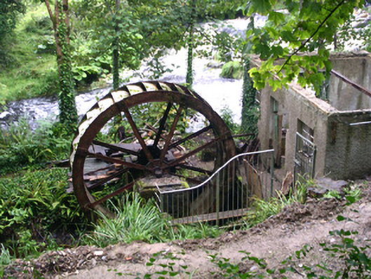 hydroelectric power stationhydroelectric power station · 1466 yd
 Foyoges Bridgebridge · 1492 yd
 Tobar Ailbhe Holy WellMemorial · 1567 yd
 Josie McDermott MemorialMemorial · 1.5 mi
 Black WoodForest · 2.1 mi
 Roundhouse Hill WoodForest · 2.1 mi
 Green IslandIslet · 2.4 mi
 Stony IslandIslet · 2.9 mi
 Carrane HillCliff · 3.0 mi
 Kilronan MountainMountain / peak · 3.1 mi