What is recorded here
Indicated is a fairy fort on a Mayo knoll, its oval platform bisected by a modern field fence yet still commanding the stream valley below. The scarp rises steeply to the south and north-west, suggesting deliberate shaping rather than casual erosion, while a small lake waits in the depression to the north-east. Cattle graze the grass interior today, but the exposed earth and broken contour hint that people once lived, watched, or feared the place before forgetting its name.
In pasture, prominently located on the top of a knoll. To NE the ground falls away steeply to a small lake filling a natural depression; to SW− NW the knoll commands a good view along the length of a small N−S stream valley.
Raised oval area or platform (24m N−S; 30m E−W) defined by a scarp. It is bisected just S of centre by a field fence on an E−W axis. The enclosing scarp (H 0.4m) is low at E−SE, but has a steeper more pronounced slope (H 1.7-2m) at S−NW where it is enhanced by the natural fall of ground. To N of the field fence, the scarp is somewhat dilapidated, with a short section at NNW−N partly dug away.
Outside the scarp at NE there is a short stretch of level ground forming a rough terrace (Wth 2m; H 0.7m). At the base of the scarp SE−SW there is a narrow berm or terrace (Wth 1m) which follows the contour of the slope; this may be related to modification of the rath in the modern era. It is not clear if these terrace-like features preserve traces of an original outer enclosing element or fosse. Traces of relict cultivation ridges, on an E-W axis, are visible in the rath interior.
The interior is grass-covered, with a thicket of gorse in the NW quadrant; a few hawthorn bushes grow around the perimeter, and along the line of the bisecting field fence. There is an enclosure (MA062-067----) is c. 60m to SW.
Compiled by: Jane O’Shaughnessy
Date of upload: 1 December 2020
The monument record does not grant public access. Check the route and ask the landowner before entering private land.
- What survives
- Recorded monument
Places near here
 bridgebridge · 922 yd
 IndicatedFairy fort / earthen ringfort · 1514 yd
 Enclosure in KillaturlyEnclosure · 1.7 mi
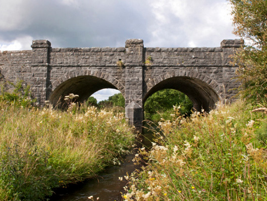 Sonnagh Bridgebridge · 1.7 mi
 Procession Of The SoulsMemorial · 2.6 mi
 Brabazon WoodsForest · 2.7 mi
 Youth Memorial GardenMemorial · 3.0 mi
 HawthornHawthorn · 4.0 mi
 Castle (in Ruins)Castle, unclassified · 4.4 mi
 Hennigan's Heritage CentreHeritage attraction · 4.5 mi
 Thorn CaveCave · 5.5 mi
 Rath Castle in ruinsCastle, tower house · 8.2 mi