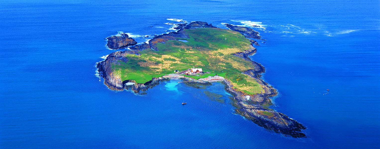
What is recorded here
Carbery Island sits off County Cork, Ireland, within a sea that has drowned villages and rewritten coastlines for millennia. The surrounding waters hold Neolithic monuments, copper mines, and shipwrecked traders, while the island itself preserves the memory of every lost coast. It is not a new place; it is the remaining edge of a region that the ocean has been erasing since before written history began.
Carbery Island is recorded as a islet in County Cork. Its open map record supplies this location and any linked names or public references.
Carbery Island is a small islet located in the River Blackwater near Ballylongford, County Kerry, and is historically associated with the ancient territory of Carbery in Munster. It is notable for its archaeological remains, including a ringfort and early Christian settlement features, reflecting its significance in early Irish history.
Places near here
 CarrigweeIslet · 218 yd
 Cold IslandIslet · 966 yd
 Dunmanus BayBay · 1.1 mi
 Dunmanus PointHeadland · 1.2 mi
 Enclosure in BallyvonaneEnclosure · 1.3 mi
 Cliff-edge fort in Knockeens (carbery West (w.d) By., Skull Par.)Cliff-edge fort · 1.3 mi
 Castle (Site of)Castle, unclassified · 1.3 mi
 Nora DaltonMemorial · 1.4 mi
 signal towersignal tower · 1.5 mi
 Kilcrohane Ch(in rns)Church · 1.5 mi
 Dunmanus Castle (in Ruins)Castle, tower house · 1.6 mi
 Farranamanagh Loop WalkWalking route · 1.8 mi
Other information
Photo: Credit not shown in the picture search · Rights wording not checked; contact us if this picture should be removed