What is recorded here
Indicated is a fairy fort on the south edge of Kiltimagh, where a round earthen ridge still holds its shape above the pasture. The land leans inward like a cupped hand, and the blackthorn at its edge makes the boundary feel alive rather than abandoned. People may have stood there to watch the bog breathe or keep something away from the house. The fort does not explain itself, but it remembers the shape of attention.
In pasture, on the S outskirts of Kiltimagh town, located on a natural rise with good views over a broad sweep of lowlying, gently undulating pasture and bog.
A raised circular area (33.3m NW–SE; 32m NE–SW) defined by an earthen scarp (H 1.3-1.5, Wth of slope 2-2.5m at SW; H 2m, Wth of slope 3.3.5m at NE) which retains a slight internal lip on the SW arc. A section of the scarp at W–NW is incorporated into a later field fence, and other sections of the scarp also show evidence of modification where the external face has been cut to the vertical or retains traces of stone facing. A poorly defined ramp-like slope (Wth 2m) in the scarp at ENE may be the site of the original entrance.
A property fence crosses the interior roughly centrally on a NW-SE axis. In the centre of the interior, abutting the NE face of the fence, is a very slight D-shaped rise (11m NW–SE; 4m NE–SW), defined on the straight side by the fence. Abutting the opposing, SW side, of the fence there is a D-shaped depression (5.7m NW–SE; 2m NE-SW; D 0.3m). The significance of these features is unclear.
The interior is grassy, and the perimeter is ringed with blackthorn and hawthorn, with some blackthorn scrub encroaching on the SW half of the interior.
Compiled by: Jane O’Shaughnessy
Date of upload: 30 November 2021
The monument record does not grant public access. Check the route and ask the landowner before entering private land.
- What survives
- Recorded monument
Places near here
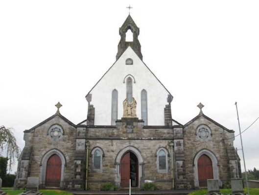 Catholic Church of the Holy Familychurch/chapel · 638 yd
 Saint Louis's Conventconvent/nunnery · 698 yd
 I'll Send You The FareMemorial · 909 yd
 Kiltimagh MuseumMuseum · 926 yd
 IndicatedFairy fort / earthen ringfort · 1004 yd
 CrossCross · 1.2 mi
 CashlankeeghCastle, unclassified · 1.8 mi
 Carrowbeg WoodWood · 1.8 mi
 Thorn CaveCave · 3.8 mi
 Knock ShrineHeritage attraction · 5.0 mi
 Ballybooley CastleCastle · 5.0 mi
 East Mayo Brigade MonumentMemorial · 6.2 mi