Places near here
Photo credits
- National Inventory of Architectural Heritage
- JohnArmagh, Wikimedia Commons · CC BY-SA 3.0
- Paul Cowan, Wikimedia Commons · CC BY-SA 2.0
- David Purchase, Geograph · Creative Commons Attribution-ShareAlike 2.0
- Mike Searle, Geograph · CC BY-SA 2.0
- Christian Pirkl, Wikimedia Commons · CC BY-SA 3.0 at
- Willow, Wikimedia Commons · CC BY 2.5
- Colin Park, Geograph · CC BY-SA 2.0
- Nigel Thompson, Wikimedia Commons · CC BY-SA 2.0
- Oliver Dixon, Geograph · CC BY-SA 2.0
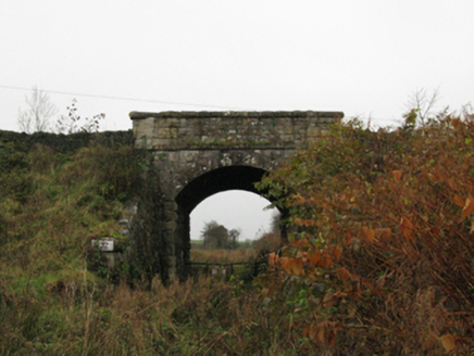 bridge600 yd
Explorer Tom The bridge in Kiltamagh took about four million cups of tea to build, according to legend. It’s tied to an old railway line that vanished into the mists. Ideal stop for a bite and a bit of gossip.
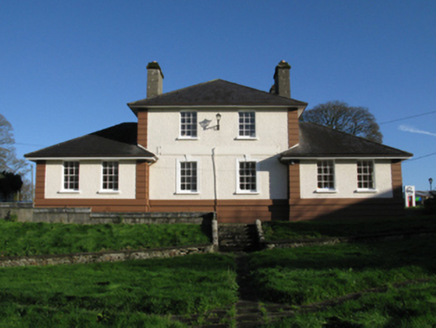 Kiltimagh Cottage HospitalHospital/infirmary · 781 yd
Explorer Tom Kiltimagh Cottage Hospital has a legend about a tunnel to the pub so patients could sneak out for pints. It was designed in 1919, so it’s seen some things. Bring a friend who likes ghost stories, they’ll fit right in.
 Round Tower4.5 mi
Explorer Tom Round Tower in Meelick is sick of being asked if it’s actually round, because yes, mate, it’s circular, stop squinting at it from a distance. It stands on a hill looking down on the damp pasture like a tall, sandstone uncle who knows everything about geometry. Bring your nan, she'll know more than me.
 Knock ShrineHeritage attraction · 5.6 mi
Explorer Tom I'll keep my big mouth quiet for the people praying at Knock. Knock Shrine grew from an evening that the people present never forgot. On 21 August 1879, Mary Byrne and other villagers said they saw figures at the church gable while the Mayo rain came down. Their accounts describe a still scene that lasted nearly two hours, with people gathering and praying; the witnesses also said the ground around the figures stayed dry. I am not going to tell you what they saw. Mayo rain rarely asks my permission, but the witnesses' account asks for careful listening. What I can tell you is that their words were taken down by a church inquiry that autumn, and a second inquiry in 1936 returned to surviving witnesses because many early papers were thought lost. The original wall attracted so many visitors that pieces were taken away as souvenirs. Today this is a living place of pilgrimage, so enter with care for the people who have come to pray. Whatever you believe, listen to how a wet evening changed a village's place in the world.
 Grave YardGraveyard · 7.2 mi
Explorer Tom Graveyard in Aghamore would post a photo of its mossy headstones with the caption 'Living my best quiet life, #ancient'. It’s got that moody, atmospheric vibe going on that makes you feel instantly profound. Have a wander and a wonder.
 CastleCastle, unclassified · 9.1 mi
Explorer Tom Castle on Island Lake hates when people ask if it’s haunted; it prefers ‘mysteriously absent’. It vanished so fast the locals just shrugged and built a house instead. Bring a flask of something warm and a story to swap.
 IndicatedHouse, fortified house · 9.1 mi
Explorer Tom House in Island is currently being judged by rabbits who think its gunloops are just fancy holes for them to hide in. They’re not wrong, actually. Get there early and have it all to yourself.
 Sycamore16 mi
Explorer Tom Sycamore’s least favourite visitor is definitely the guy who tries to climb it in his dress shoes and complains about the leaves. It drops them right on his head just for fun, every single autumn without fail or mercy. It's the kind of place that makes a dull Tuesday interesting.
 European ash19 mi
Explorer Tom European ash is what the builder was really thinking when he decided to chop down the perfect straight timber for the roof beams. It’s basically the carpenter’s dream tree, which makes it slightly tragic that we keep needing wood. Take the long way round, it deserves the effort.
 KnockaffertaghMountain / peak · 21 mi
Explorer Tom Knockaffertagh’s least favourite visitor is definitely anyone who suggests taking a selfie on top because it ruins the vibe. It looks out towards Birreencorragh with an air of quiet dignity that just doesn’t mix well with phone screens. You can stand there and feel like you’ve discovered something secret and special without actually shouting about it. Great spot to propose. Or at least to propose.
 Neale CemeteryCemetery · 22 mi
Explorer Tom Neale Cemetery in Mayo was supposedly invented by a local lad who just needed somewhere to park his tractor, apparently. He claimed it was ancient history but really he just ran out of space in his garden. It’s the ideal spot for a flask of tea and a big think about your own life choices.
 Runnet HillMountain / peak · 23 mi
Explorer Tom Runnet Hill is currently in a feud with the rain because it keeps getting soaked. The hill wants to stay dry and sunny, but the sky just won’t listen to its complaints. It’s a bit grumpy about the whole situation, so give it space and a towel. Stop the car, it's worth the hazard lights.
More archaeology and monuments in County Mayo · All of County Mayo

What do you know about this place?Tap to add a comment or ask a question