What is recorded here
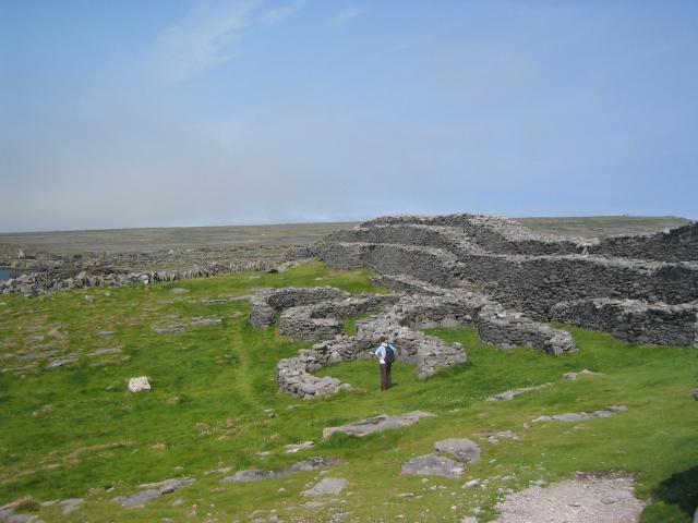
Doocaher is a coastal promontory fort on the southwest cliff of Inis Mór, where a massive drystone rampart still guards a boulder-strewn limestone plateau above the sea. The fort measures about 110 metres by 80 metres, and its landward wall stretches 73 metres with a width of 7.2 metres and height of 3.7 metres. A destroyed western entrance and dense outer defences suggest this was no ordinary dwelling but a place built to resist approach from every direction. People may have watched ships, stored what the land gave, or simply refused to be forgotten on that exposed edge of the world.
On a sheer cliff-top headland on SW side of Inis Mór. This Nat. Mon. is known locally as Dún Dúcathair. It consists of an irregular boulder-strewn area of limestone pavement (110m by 80m max.) defined to landward (NE) by a massive drystone rampart (L c. 73m, Wth 7.2m, H 3.7m). Both the inner face of the rampart, with three terraces connected by steps, and the buttressed outer face are the result of 19th-C restoration. Traces of an entrance (Wth 2.2m) survive at E end but Westropp, citing Petrie in 1821, states that it 'had a perfect entrance to the west, destroyed ... by a great cliff-fall before 1839' (1914, 333-4). Outside the rampart is a dense band of chevaux-de-frise (Wth 55m max.) and within it are two groups of houses (GA119-001001-, GA119-002----). (O'Flanagan 1927a, Vol. 3, 242-50; Robinson 1986, 37-40)
The above description is derived from the published 'Archaeological Inventory of County Galway Vol. I - West Galway'. Compiled by Paul Gosling (Dublin: Stationery Office, 1993).
Date of upload: 05 August 2010
The monument was taken into Ownership under the National Monuments Acts 1930 to 2014 - National Monument 43.
The monument record does not grant public access. Check the route and ask the landowner before entering private land.
- What survives
- Recorded monument
Places near here
 Fairy fort / stone ringfort in Cill ÉinneFairy fort / stone ringfort · 1015 yd
 Holy Well (now dry)Holy well · 1237 yd
 Scoil Náisiúnta Cill Éinneschool · 1459 yd
 school master's houseschool master's house · 1475 yd
 Teampall BheanáinHeritage attraction · 1597 yd
 Arkin's CastleCastle · 1.0 mi
 Leaba Naomh RónáinHeritage attraction · 1.6 mi
 An CharcairMountain / peak · 1.6 mi
 Trá na mBuailte (Beach of the Booly)Beach / strand · 2.0 mi
 ÁrainnIsland · 2.1 mi
 Seal Colony LookoutViewpoint · 2.5 mi
 Oileán na TuíIslet · 2.6 mi
Other information
Photo: Tom Pullman · CC BY-SA 2.0