What is recorded here
At Cill Charna c. 2.5m N of a possible church (GA110-159001-). Described by Barry (1886, 493) as 'A dripping well…called “Tobarchora” '; correctly Tobar Charna. All that is visible today is a small circular hole, blocked by rubble, in S part of a ruined rectangular drystone enclosure (L 8m, Wth 7m) which is built of limestone flags set on edge. I - West Galway'. Edited by: Olive Alcock
Date of revised upload: 3 February 2023
From the National Monuments Service (Archaeological Survey of Ireland) record GA110-159002
The monument record does not grant public access. Check the route and ask the landowner before entering private land.
- What survives
- Recorded monument
Places near here
Photo credits
- Tom Pullman, Wikimedia Commons · CC BY-SA 2.0
- National Inventory of Architectural Heritage
- Ronan Mac Giollapharaic, Wikimedia Commons · CC BY-SA 4.0
- Guilhem Boyer, Wikimedia Commons · CC BY-SA 3.0
- Herbert Ortner, Wikimedia Commons · CC BY 3.0
- Marathon, Geograph · CC BY-SA 2.0
- Gordon Hatton, Geograph · CC BY-SA 2.0
- Chairego apc, Wikimedia Commons · CC BY-SA 4.0
- Colin Park, Geograph · CC BY-SA 2.0
 DoocaherPromontory fort, coastal · 1237 yd
 monument1409 yd
 monument1430 yd
 Dún EochlaHeritage attraction · 1722 yd
 Teampall BheanáinHeritage attraction · 1.3 mi
 Arkin's CastleCastle · 1.3 mi
 St. Eanys WellHoly well · 1.3 mi
 ÁrainnIsland · 1.7 mi
 Seal Colony LookoutViewpoint · 1.9 mi
 Inis MeáinIsland · 4.6 mi
 Cnoc RaithníVisitor information · 7.7 mi
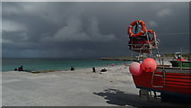 Lár na TráBeach / strand · 7.8 mi
More archaeology and monuments in County Galway · All of County Galway
What do you know about this place?