What is recorded here
The graveyard in Churchtown (Rosslare parish, Kilscoran Ed) is in County Wexford, Ireland. It sits on a slight rise in a low-lying, gently rolling landscape, about 120 metres west of the R736 Tagoat to Rosslare Strand road, and is reached by a lane. The parish church of Rosslare stands within a pentagonal graveyard measuring approximately 60 metres east-west and 45 metres north-south, which is defined by an earthen bank with a masonry wall in places.
Situated on a slight rise in a low-lying, gently rolling landscape, and c. 120m W of the R736 Tagoat to Rosslare Strand road, accessed by a lane. The parish church of Rosslare (WX048-006001-) is within a pentagonal graveyard (dims c. 60m E-W; c. 45m N-S) defined by earthen bank with a masonry wall in places.
Compiled by: Michael Moore
Date of upload: 6 January, 2014
The monument record does not grant public access. Check the route and ask the landowner before entering private land.
- What survives
- Recorded monument
Places near here
 Church in ruinsChurch · 13 yd
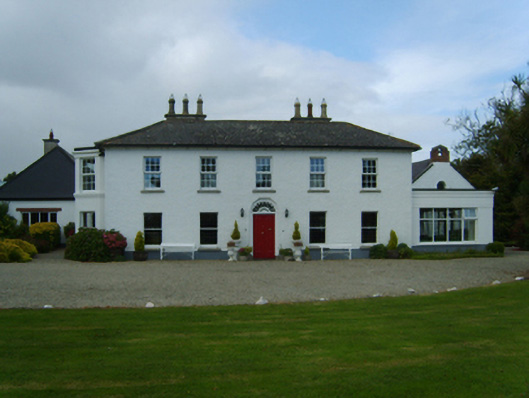 Churchtown Housefarm house · 543 yd
 Wind MillWindmill · 774 yd
 St. Marys WellHoly well · 1448 yd
 Birdlife of RosslareVisitor information · 1.1 mi
 Marconi HouseMemorial · 1.4 mi
 Rosslare Harbour Maritime Heritage CentreMuseum · 2.0 mi
 CastleCastle, unclassified · 2.0 mi
 Rosslare Strand BeachBeach / strand · 2.2 mi
 BirdlifeVisitor information · 2.9 mi
 James Stevens Lifeboat MemorialMemorial · 2.9 mi
 Ballyrane Castle (in ruins)Castle, tower house · 2.9 mi