
What is recorded here
Situated on a slight rise in a low-lying, gently rolling landscape, and c. 120m W of the R736 Tagoat to Rosslare Strand road, accessed by a lane (L c. 115m). The parish church of Rosslare is within a pentagonal graveyard (dims c. 60m E-W; c. 45m N-S) defined by earthen banks with a masonry wall in places. Some of the clergy of St. Mary’s, Rosslare, are known 1389-1550 (Hore 1949, 53). According to the Visitation of Thomas Ram, the Protestant bishop of Ferns, in 1615 Thomas Gallamore was rector and the vicar was Richard Reigh, and the church was in repair (Hore 1900-11, vol. 6, 267).
The church consists of a nave and chancel. Of the nave (int. dims 13m E-W; 6.1m plus N-S) only the W wall (H 2m) partly survives although John O’Donovan writing c. 1840 describes a double belfry at its apex (O’Flanagan 1933, vol. 1, 277). The chancel (int. dims 5.8-5.95m E-W; 4.4-4.68m N-S) survives almost complete to the roof level (H 2.4-2.6m), although the walls are clay-bonded. The pointed chancel arch (Wth 2.05m; H 2.2m) has undressed voussoirs and there is a cupboard on the E face of each pier (Wth 0.9m). There is a two light window (Wth 0.58m; H 1.08m) with granite surrounds, round-head lights and glazing grooves in the E wall but the central mullion is missing. The N and S walls each have two windows that are destroyed or blocked, but the W ones have evidence of glazing grooves. There is a plain tomb niche (Wth 2.2m; H 0.9m; D 0.44m) in the centre of the N chancel wall and a small, partly destroyed, aumbry at the E end of the S wall. St. Mary’s Well (WX048-013----) is c. 1.3km to the S.
The above description is derived from the published 'Archaeological Inventory of County Wexford' (Dublin: Stationery Office, 1996). In certain instances the entries have been revised and updated in the light of recent research.
Compiled by: Michael Moore
Date of upload/revision: 6 January 2014
The monument record does not grant public access. Check the route and ask the landowner before entering private land.
- What survives
- Recorded monument
Places near here
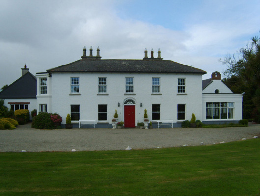 Churchtown Housefarm house · 542 yd
 Wind MillWindmill · 773 yd
 Corn MillMill, corn · 1078 yd
 St. Marys WellHoly well · 1446 yd
 Birdlife of RosslareVisitor information · 1.1 mi
 Marconi HouseMemorial · 1.4 mi
 Rosslare Harbour Maritime Heritage CentreMuseum · 1.9 mi
 CastleCastle, unclassified · 2.0 mi
 Rosslare Strand BeachBeach / strand · 2.2 mi
 BirdlifeVisitor information · 2.9 mi
 James Stevens Lifeboat MemorialMemorial · 2.9 mi
 Ballyrane Castle (in ruins)Castle, tower house · 2.9 mi
Other information
Photo: Credit not shown in the picture search · Rights wording not checked; contact us if this picture should be removed