
What is recorded here
A well is marked on the 1839 and 1940 eds of the OS 6-inch map and described in gothic lettering on both as St. Mary’s Well. It is situated on a slight W-facing slope and on the W side of the S-N road (R736) from Tagoat to Rosslare Strand. It is opposite the Roman Catholic church in Tagoat.
The well is subcircular (int. diam. 0.9m E-W; 0.86m N-S) with a domed canopy of brick (max. H 1m), and has an opening (Wth 0.5m; H 0.8m) facing N. There is a limestone sill at the opening, which has a projecting masonry ‘pier’ on either side. There are no offerings at the well, and there is no record of a pattern, but it was probably connected with the parish church of Rosslare (WX048-006001-) c. 1.3km to the N, which was dedicated to the Blessed Virgin. Archaeological testing (01E0734) c. 70m to the E and c. 70m to the W at the closest points produced no related material (Stafford 2002; excavations.ie 2001:1316).
Compiled by: Michael Moore
Date of upload: 7 January, 2014
Amended; 1 December 2020
St. Mary's Well is traditionally associated with the veneration of the Virgin Mary and was likely a site of pilgrimage and healing rituals. Historical mapping suggests its longstanding recognition, though specific cures or folklore linked to the well are not well documented.
The monument record does not grant public access. Check the route and ask the landowner before entering private land.
- What survives
- Recorded monument
Places near here
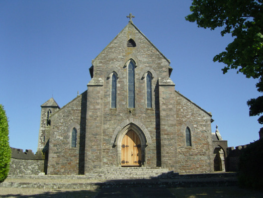 Saint Mary's Catholic Churchchurch/chapel · 77 yd
 Corn MillMill, corn · 705 yd
 Enclosure in SladEnclosure · 755 yd
 site of ChurchChurch · 853 yd
 CastleCastle, tower house · 1314 yd
 Rosslare Harbour Maritime Heritage CentreMuseum · 1.7 mi
 Birdlife of RosslareVisitor information · 1.9 mi
 Marconi HouseMemorial · 2.2 mi
 Ballyrane Castle (in ruins)Castle, tower house · 2.9 mi
 The Fairy Stone/RockNamed rock · 2.9 mi
 Rosslare Strand BeachBeach / strand · 3.0 mi
 Shernock Hill/Knocks HillMountain / peak · 3.1 mi
Other information
Photo: Credit not shown in the picture search · Rights wording not checked; contact us if this picture should be removed